Urban design studio - Arch 301
Tutors: Maria Hadjisoteriou, Angela K. Petrou, Paris Philippou
Year: Fall 2013

PART 1 SITE RESEARCH
‘INDUSTRIAL EDGELANDS’
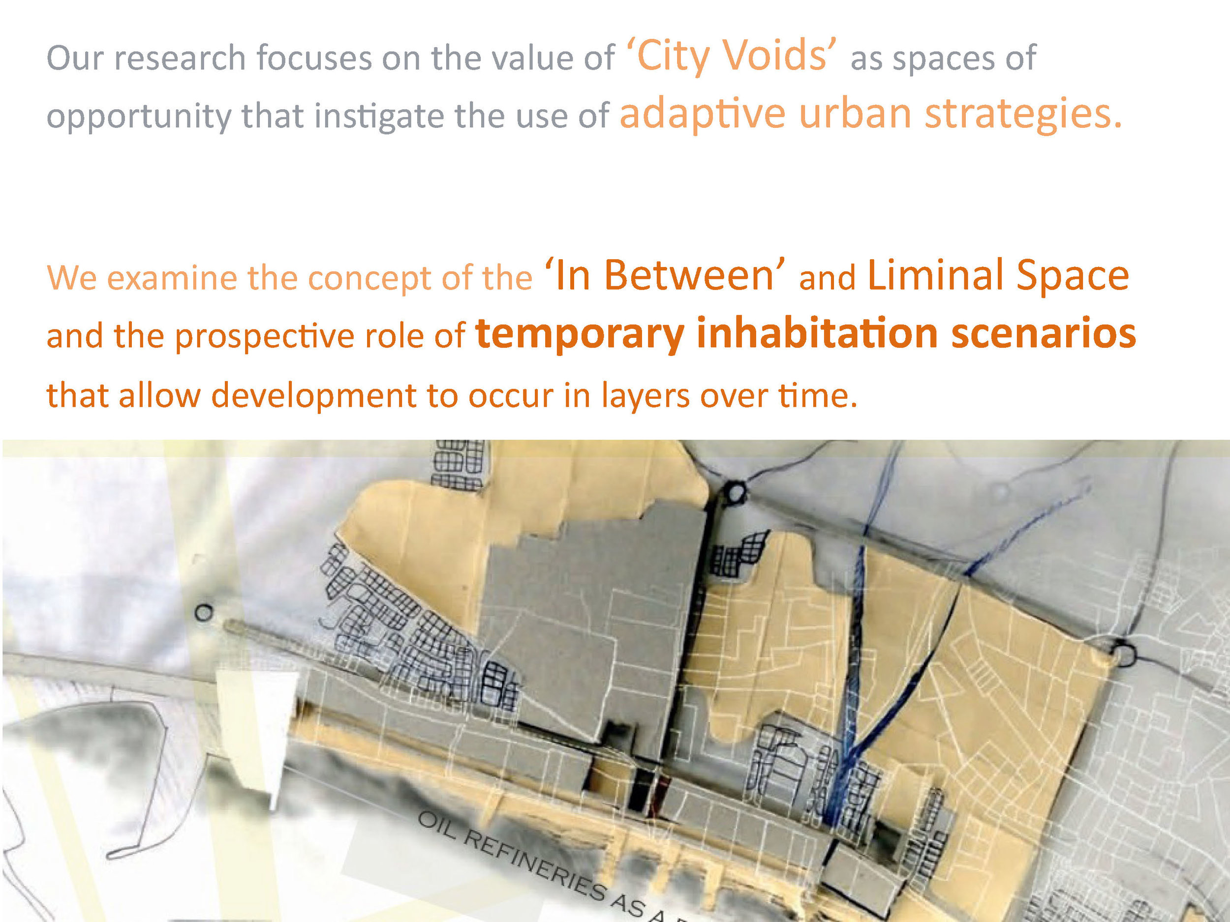
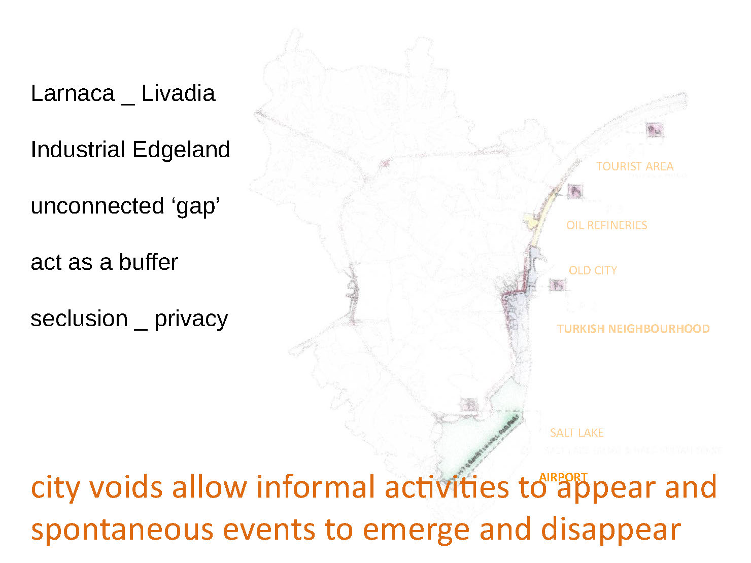
Our site is the area of the Livadia oil refineries and the surrounding neighbourhoods in Larnaca. We have identified this site as an“ Industrial Edgeland” as it acts as an unconnected ‘gap’ in the city of Larnaca.
For the Urban Studio the site is not a given, students must identify and investigate the layered context of the site and its relation to the city operating at multiple scales. Through various recordings and mappings students will discover the urban qualities and characteristics that are embedded in the area.
The aim of the project is to begin to understand the realities and characteristics of the area itself at the micro scale, as well as the way it relates and participates (or not) in the metropolitan scale of Larnaca (macro scale). It is important that student develop their research work using parallel tools of observation therefore it is expected the chosen method of presentation will reflect the scale and convey the qualities of the site.


PART 2 WORKSHOP URBAN GAME
URBAN GAMES
1. NEGOTIATING THE COAST
2. ALTERNATIVE NETWORKS
3. RESISTANCE AS A POSITIVE CONDITION
4. EXTENDING THRESHOLDS
5. OVERLAPS
6. NODAL TRANSFORMATION
After the analysis of the 1st project under the categories of: urban blocks, networks / infrastructure and in‐between spaces, we identified the above six thematic to be the main investigation for the urban game.
Students are placed in the thematic groups based on their interests and analytical work of the 1st project.
The objective of the workshop is to comprehend the city as a system where the element of chance can play a significant role in the urban development.
The urban game gives us the opportunity to play with the idea of displacement of urban elements and allow mechanisms where the juxtaposition of diverse conditions can be studied as a generator for innovative urban proposals.


Objectives Of Larnaca Master Plan In The Urban Studio
The master plan objectives emphasised the need for a flexible and adaptive city planning strategy. The main requirements were for the proposed plan to become more responsive to new needs and demands of its users and at the same time provide opportunities & incentives for larger scale developments. The objectives where considered under specific conditions:
Enhancing connectivity of the industrial area with the city and between the city and the coast Exploring relations between existing adjacent programmes; Respecting smaller scale existing activities
Programmatic investigation and innovative uses to bring new life to the area and create identity. The question of uses and its possible elasticity, especially concerning the challenging fringe conditions
Sea front development _ Creating public open space _ open access to the sea front
Respecting the site’s cultural and built heritage and addressing the issue of how to negotiate the matters of memory and preservation along with new use and adaption.
Development in time (Phasing) considering the independent development of the different pieces, as well as unforeseeable dynamics concerning the restructuring of the area
Transport and mobility: The proposals shall take into account the access conditions to the site and the mobility solutions (roads, rail, pedestrian lanes and parking space…) A new mobility concept has been promoted by local authorities to promote regional pedestrian tourism.
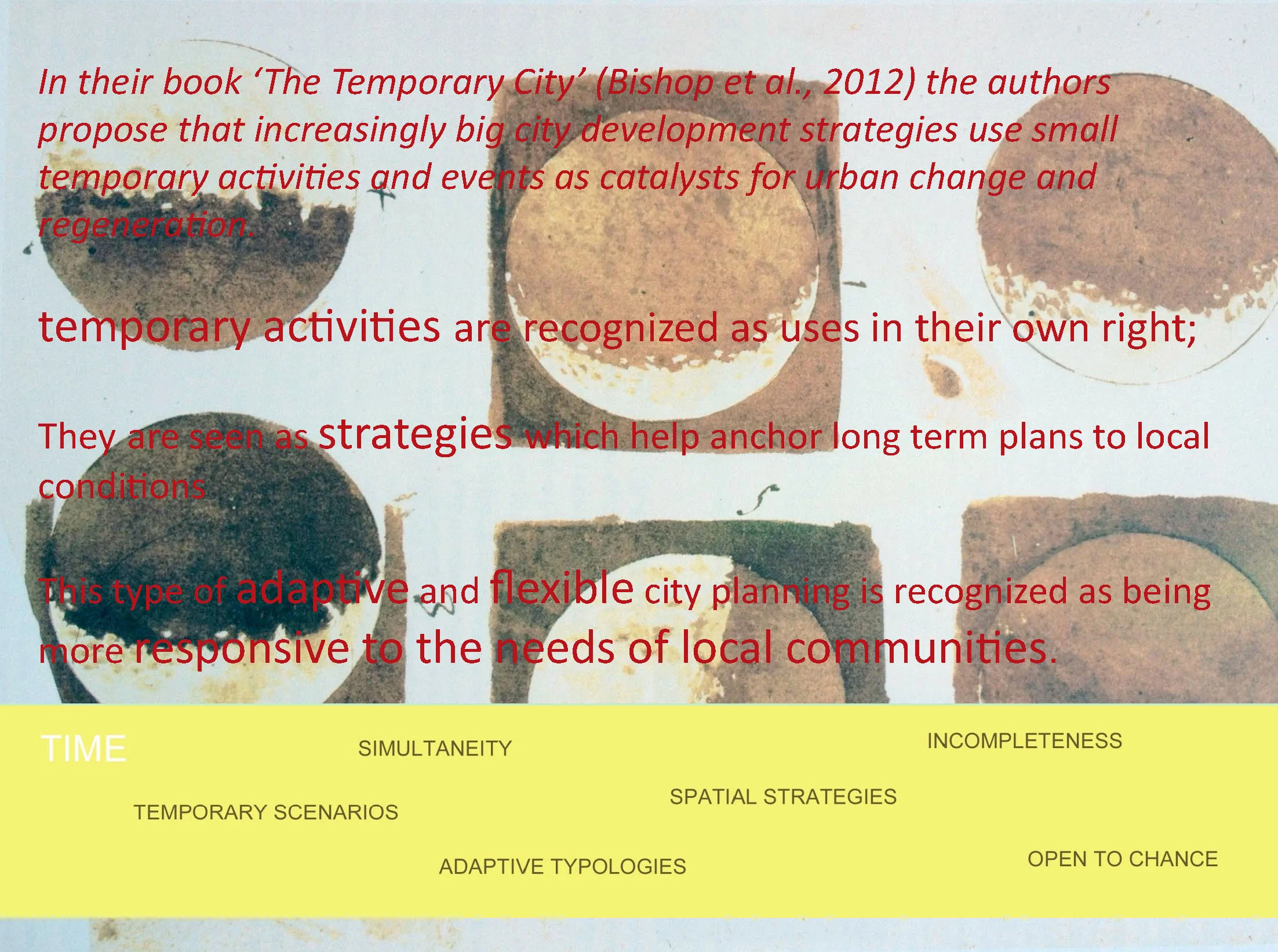
Temporary and permanent activities as discussed in the book: “the temporary city” where the temporary program is been used as the catalyst to enhance economic growth
Big Overlaps
Student team: E.Demitriou, P.Rotsides, Ch. Evagorou
The "big overlaps" project1 identified two parallel strips, the main road network along the coast and the coastal line. Between these two strips lies the in-between condition where the oil refineries are placed. By the process of identifying existing nodes and creating new ones where new and old activities co-exist, this proposal is based on treating these nodal in between areas and extending them within the city.
Porosity: The "big overlaps" work with the idea of porosity in order to activate the area; Overlapping and exchanging of spatial conditions are proposed.
Nodes: are identified as an opportunity for regeneration and are used as a main design strategy. The nodes are discussed as "city magnets" (Beigel, et al. 2010) they act as densifications in the city, where diverse activities co-exist in different densities and time frames, creating a liveable space. These nodal areas are connected between them and with the rest of the city, through their permeable boundaries.
Negotiating the coast by adding and removing land is proposed, in order to extend the city to the sea and the sea to the inner part of the city.
New networks: by breaking the boundaries, formal and informal paths are proposed that allow perpendicular circulation to the coastal line, connecting in this way the two strips between them and with the inner area of the city.


Alternative Networks
Student team: S. Crysanthou, Chr. Galanou
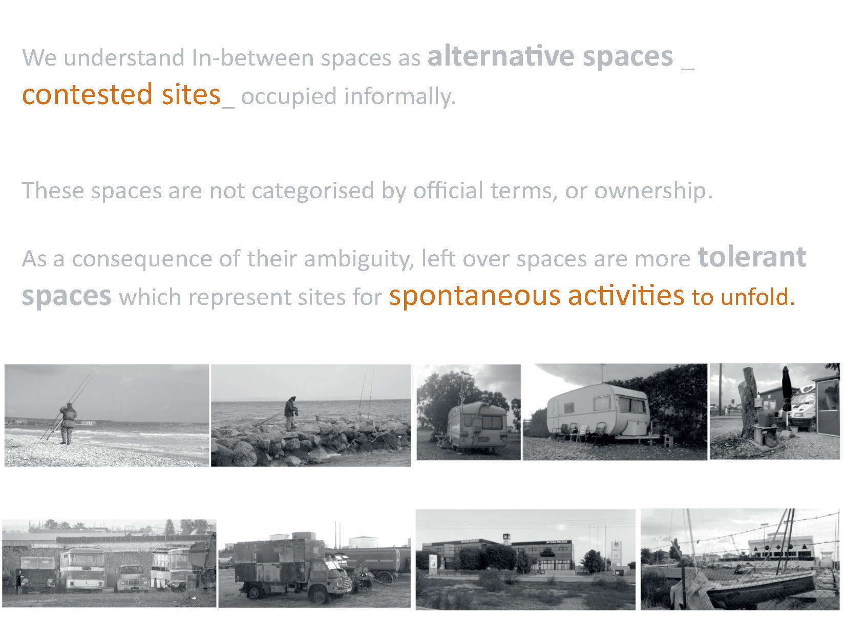
The proposal "alternative networks" investigated the in-between areas through the categorization of their boundaries. By Identifying existing small scale activities, temporary events and seasonal activities, and linking them with their boundary conditions, allowed for a re-reading of the city, seeing its temporary character as an urban opportunity.
The project identified typologies of in-between spaces (territories and activities) through the observation and categorization of boundaries, paths and alternative connections to and between open spaces.
Boundaries were mapped as:
Physical boundaries (nature– vegetation – sea coast), artificial boundaries and “occupational” boundaries (formed from activities)
Permanent and temporary boundaries
Rigid vs Penetrable boundaries
Accessibility towards, from and through boundaries was mapped: Formal and Informal access, alternative paths, traces from the in-between areas to other "vague terrain" were recorded, discussed and proposed as alternative networks. Indirect access not easily accessible allowed alternative activities to take place (like fishing, camping …)


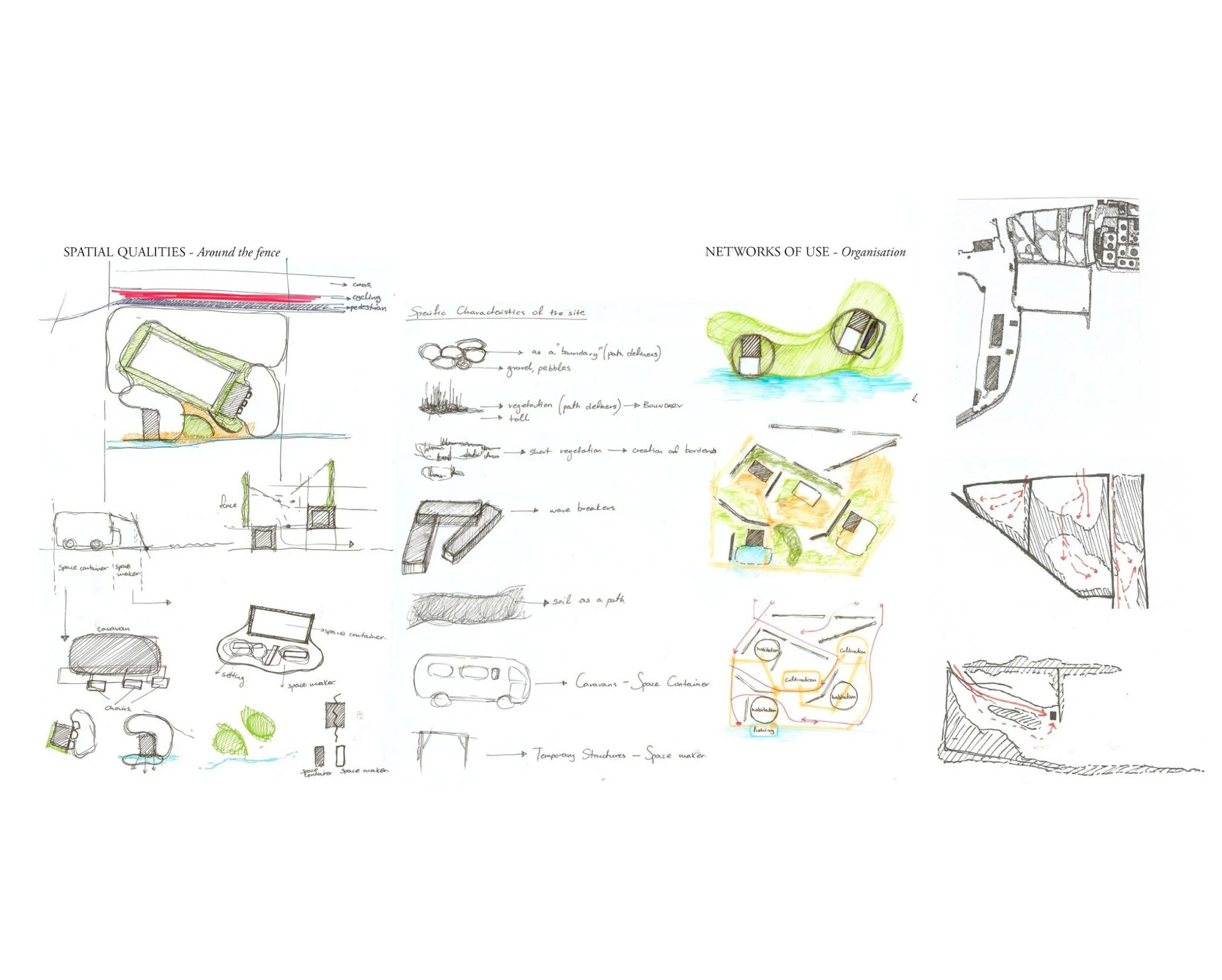


Defined Typologies:
C.amping and temporary homes where identified as a “family activity”, that is characterised by appropriation and extension of activity within its border zone and along its adjacent coastal line. Caravans were found nestled and visually concealed from the main network, near the coastal edge, next to the site’s boundaries and vegetation. This family activity is a facilitator feeding other networks of activities allowing them to occur, such as fishing and swimming.
F.ishing was found at the extremities of land protrusions into the sea, or at instances of penetrable boundary zones at the coastal edge. It is often found at a relative distance from access points from the main network to the coast, or beyond a threshold.
S.wimming interferes with fishing, these two systems can be generally considered as mutually exclusive. Swimming usually takes place at softer coastal edges, extending from appropriated vegetation boundaries which offer shade and privacy points along the primary network
S.treet vendors were discussed as “occupational” boundaries. Road sellers were found at nodes and confluences of different types of networks and often at informal access points to the coastal edge. The area around them can be appropriated. They are mobile and tend to move along the primary network according to the density of activity.
O.il refineries were characterised by double boundaries, the outer most allows free movement of users within it and the inner-most confines the smaller compartments whilst allowing for movement via small bridge-like platforms. Although the whole expanse is seen as a boundary to the public realm, it is in reality a semi-private container of smaller, more private spaces, surrounded by a border zone which gives rise to activities along its external periphery.
Fd. – ields has discontinuous and/or penetrable boundaries, along which a border of vegetation is developed, often due to diminished activity within. Activities found in these areas are instead transient. The edges are therefore ever changing following and also defining these momentary, but persistent flows Static elements that locally strengthen its boundary are often found in the form of abandoned objects. In contrast to the ‘O’ typology, the whole site behaves as an organic system that is only loosely defined.


Project planning proposal
Through the results of the game exploring alternative networks, the changed conditions and added networks links were revealed for the chosen site. These conditions were then examined in the context of the site itself, especially as to how they interacted with the current uses. Some existing uses were kept and formalised, while other were introduced and were dispersed through the site. Taking the themes of fragmentation, networks of uses, secluded and unexpected places and time, some existing boundaries were broken while others were introduced and were dispersed through the site. Spatial characteristics of the site were grouped into families leading to a ‘module’, consisting of a space container, space maker a private boundary and public use.
In both projects, the “big overlaps” as well as the “alternative networks”, it is evident that the proposals were built on existing observations, after mapping the existing conditions of the in-between spaces. The planning strategy was achieved initially by displacement of conditions and uses. Ideas of permeable boundaries, porosity, fragmentation, unexpected uses and time zones were developed as tactics that worked with the specific areas. The projects were proposed as a series of layers that changed and extended over time.
