SALINA MUNICIPAL PARK

European architectural competition for “Salina Municipal Park”
Status: design proposal, Competition entry
Principle architects: Maria Hadjisoteriou, Margarita Danou
Collaborators: Manos Doulianakis, Panagiotis Kontonis, Giorgos Moulazimis, Maria Doxastaki, Penny Papadopoulou, Irene Gregoriou.
Date: 2020
Client: Municipality of Larnaca

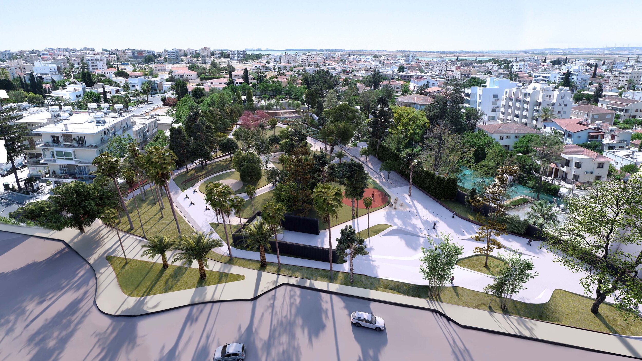
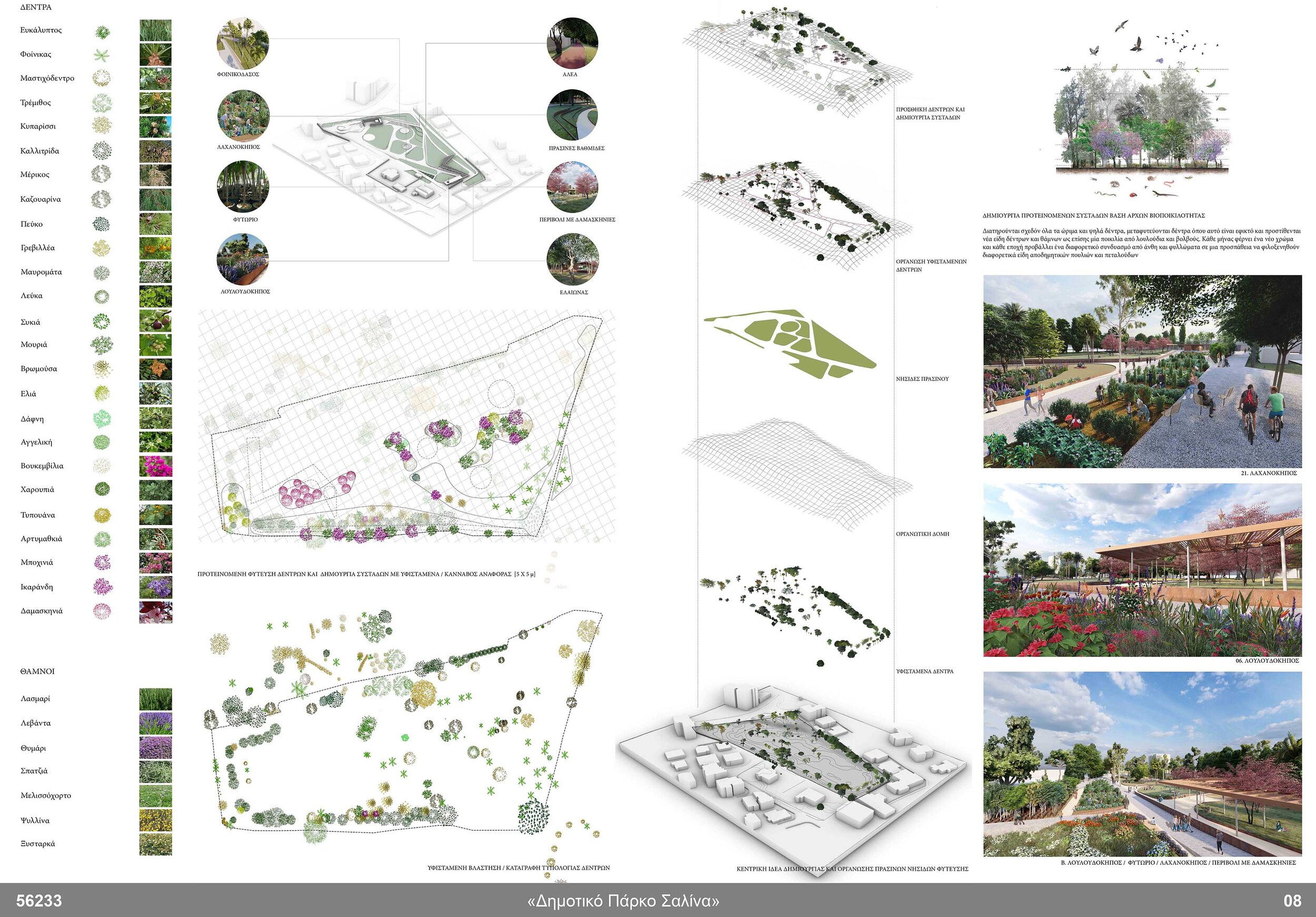
The proposal is based on two scales of investigation, a micro and a macro scale.
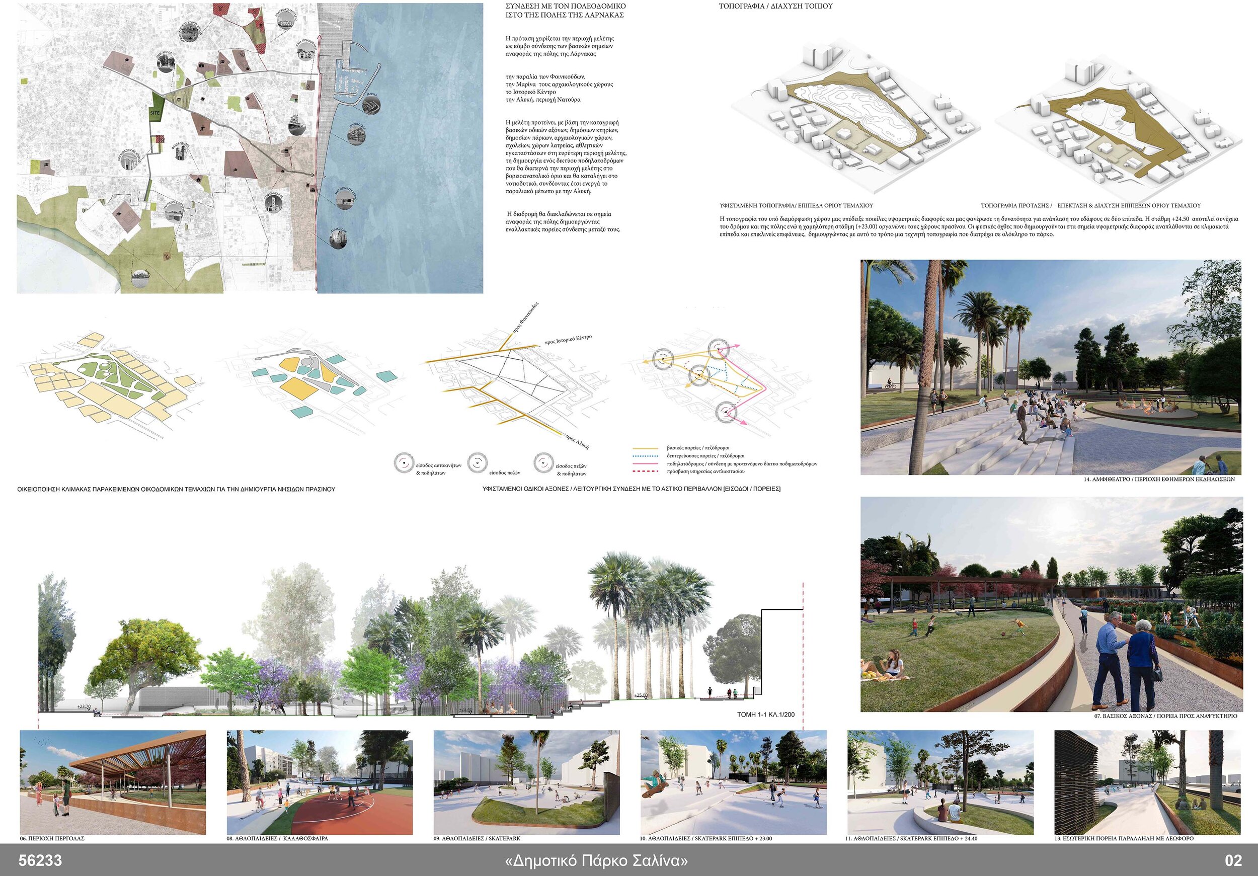
In the macro scale the Salina green park is discussed as a new urban node for the city of Larnaca. A thorough mapping of existing nodes and flows in the urban context was the base for a proposed urban network in the wider metropolitan area that connects the Salina Park with the beach of Finikoudes and the Marina in the east, the archeological sites in the northwest, the historic Center in the northeast and Aliki natura park in the south.
A new bicycle network connection is proposed that branches out to landmarks in the city such as churches, squares, sports facilities, public parks and schools, creating alternative connecting paths that utilizes the site of Salina as an interactive node that various events and activities unfold.

Mapping_ Urban connections_ Nodes & Flows

green-islands _ appropriating neighborhood’s urban block’s scale road network inserting new axis entry points & proposed paths
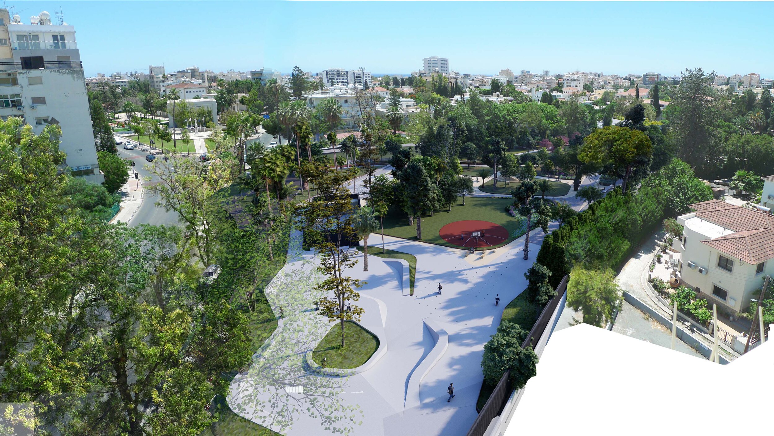
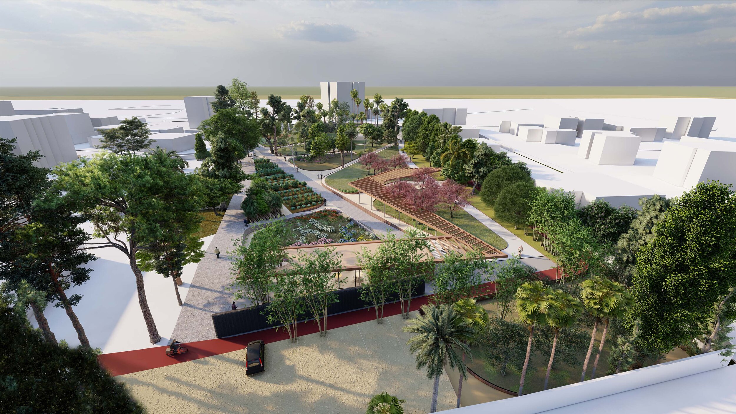
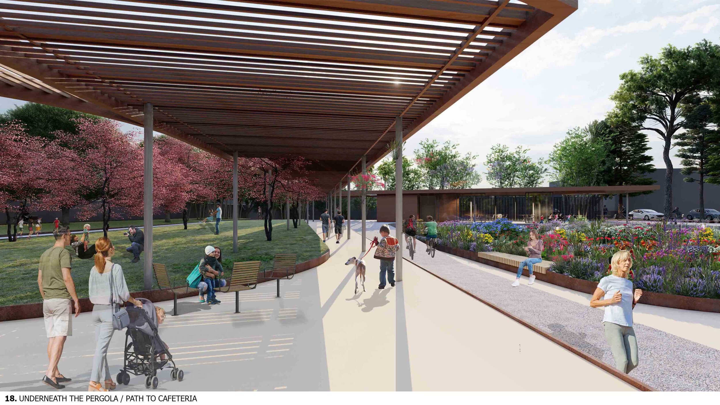
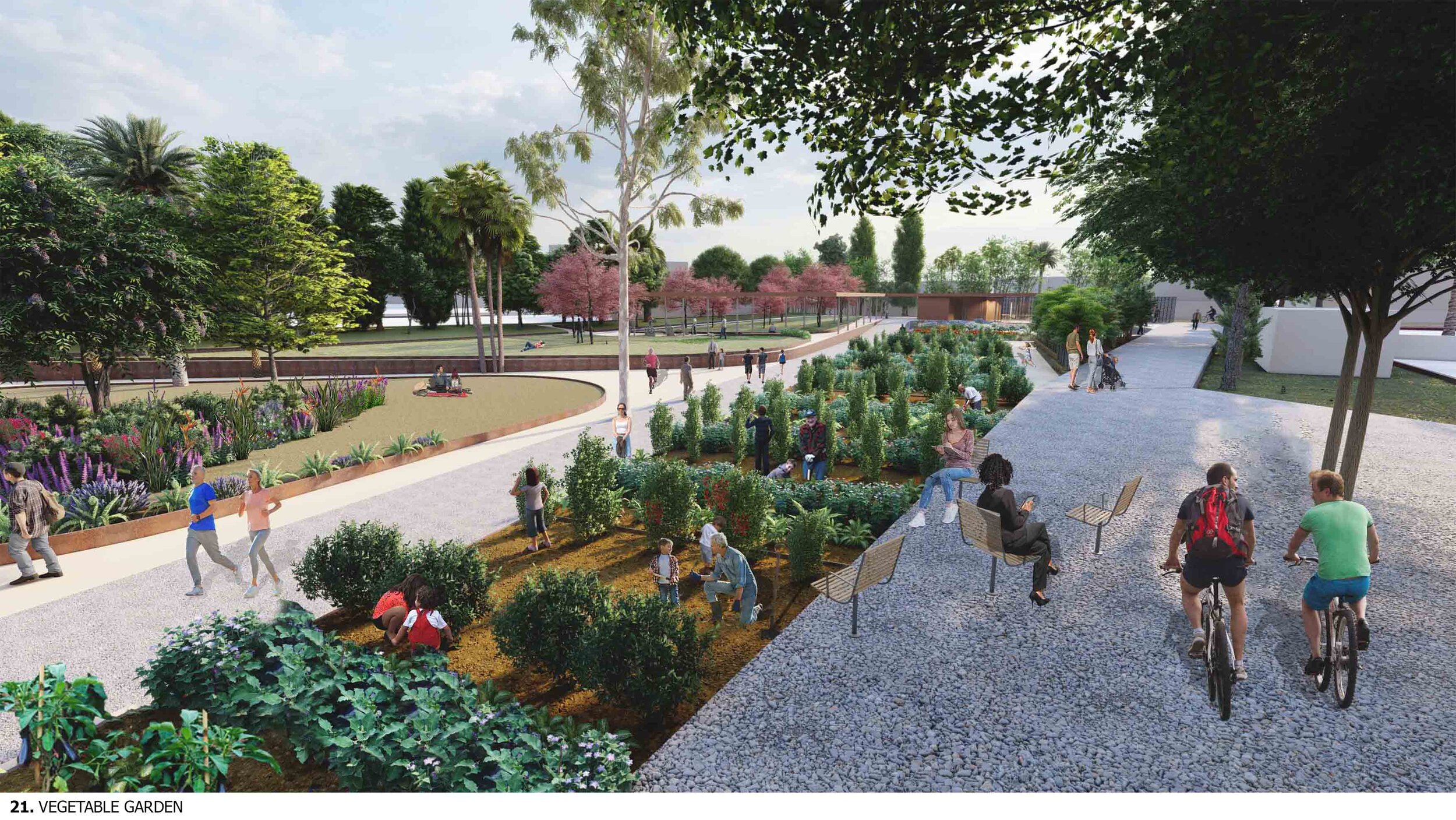
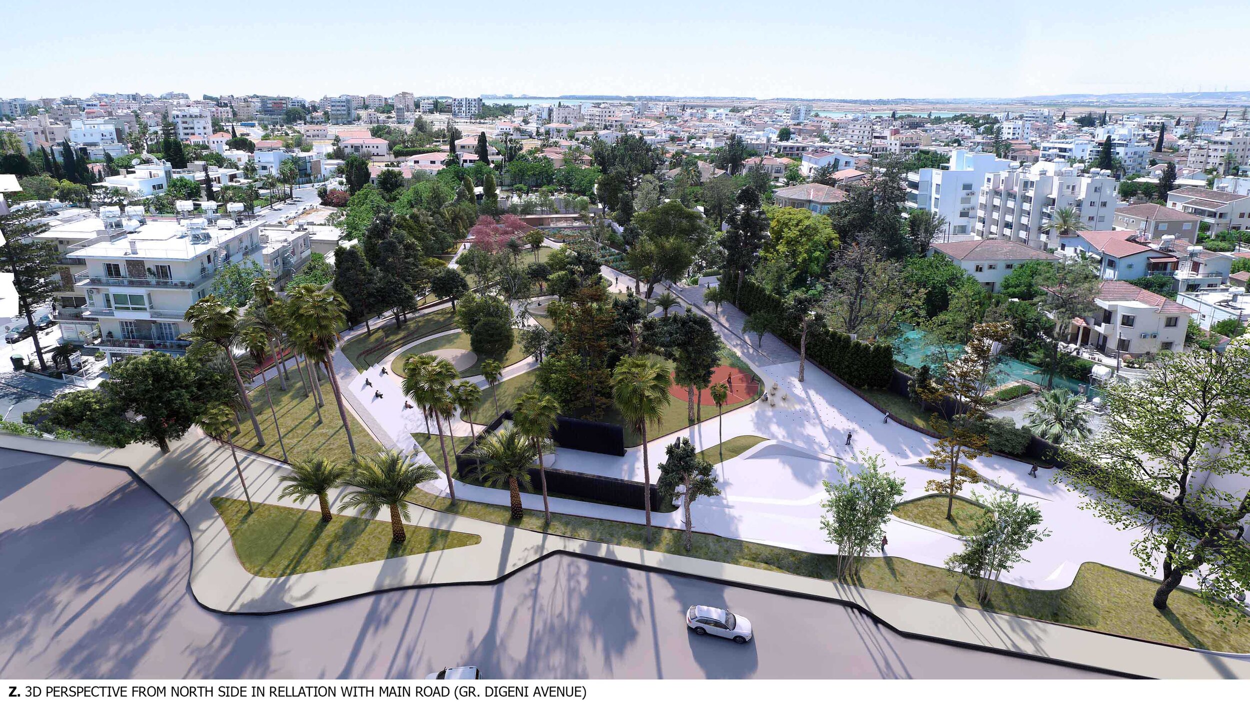
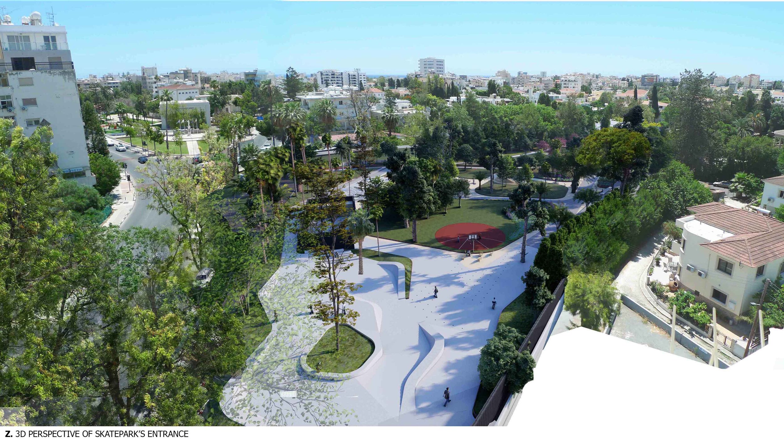
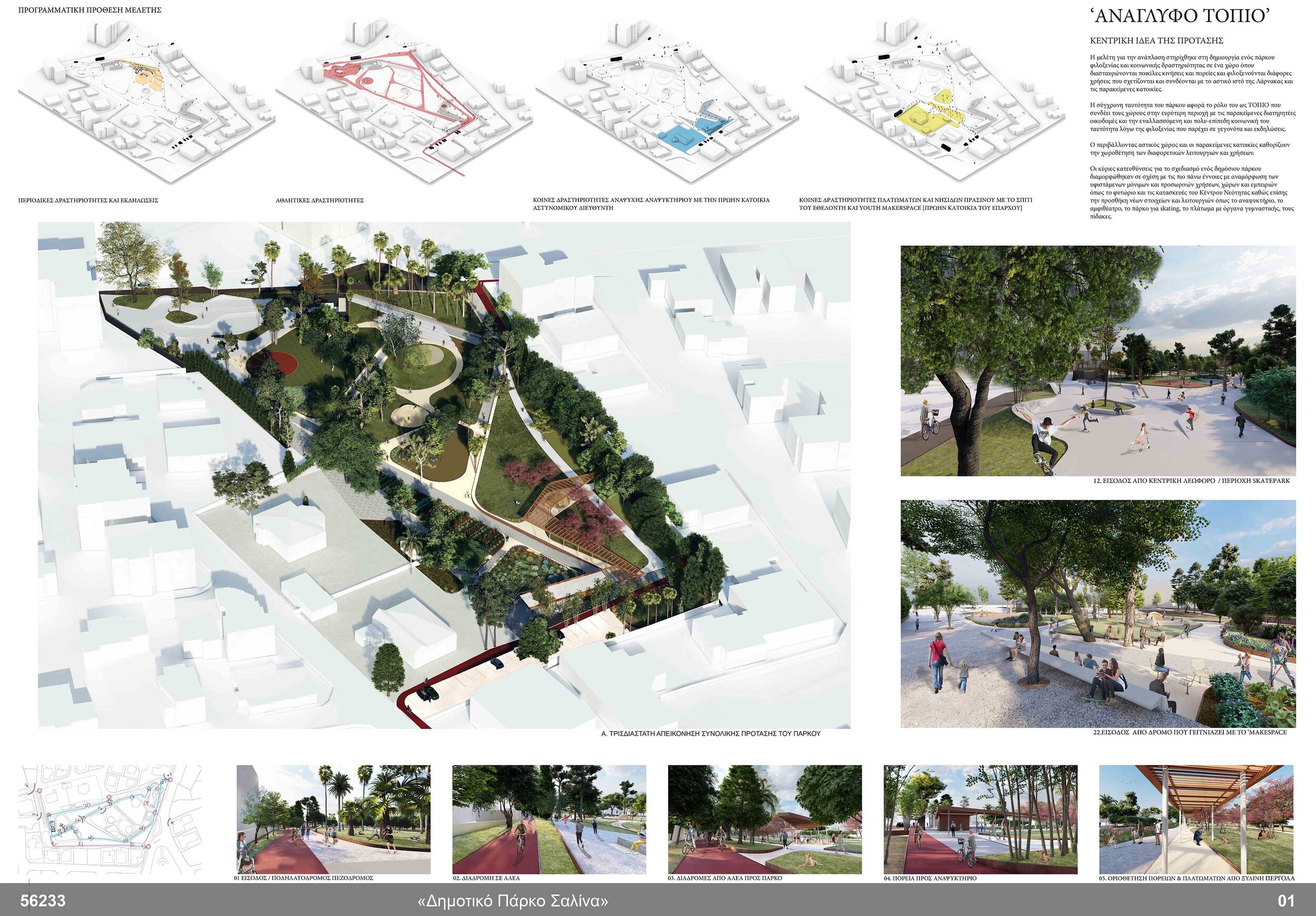
In a micro scale, the proposal identifies a programmatic intention where an existing green void in the center of Larnaca is re-defined as a public green gathering space with walking paths, activities that enhance culture, leisure and informal sport activities.
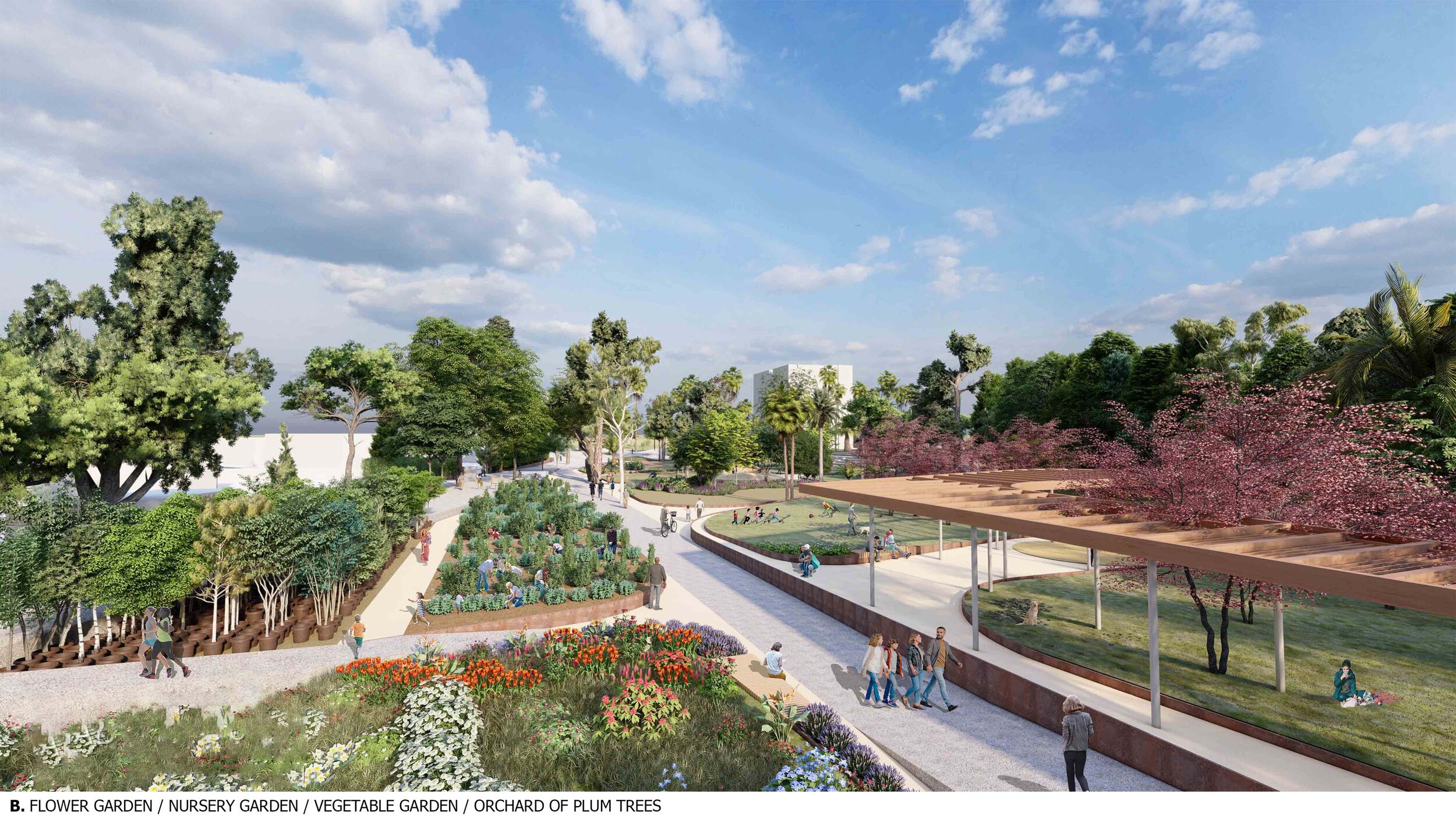
Getting inspired by the existing permanent and temporary uses, spaces and experiences of the site, scenarios of possible inhabitation where studied in order to activate the site 24/7 and relate it to the surrounding uses. Thus activities were categorised in four thematic, culture, daily athletism, leisure, planting and prototyping.
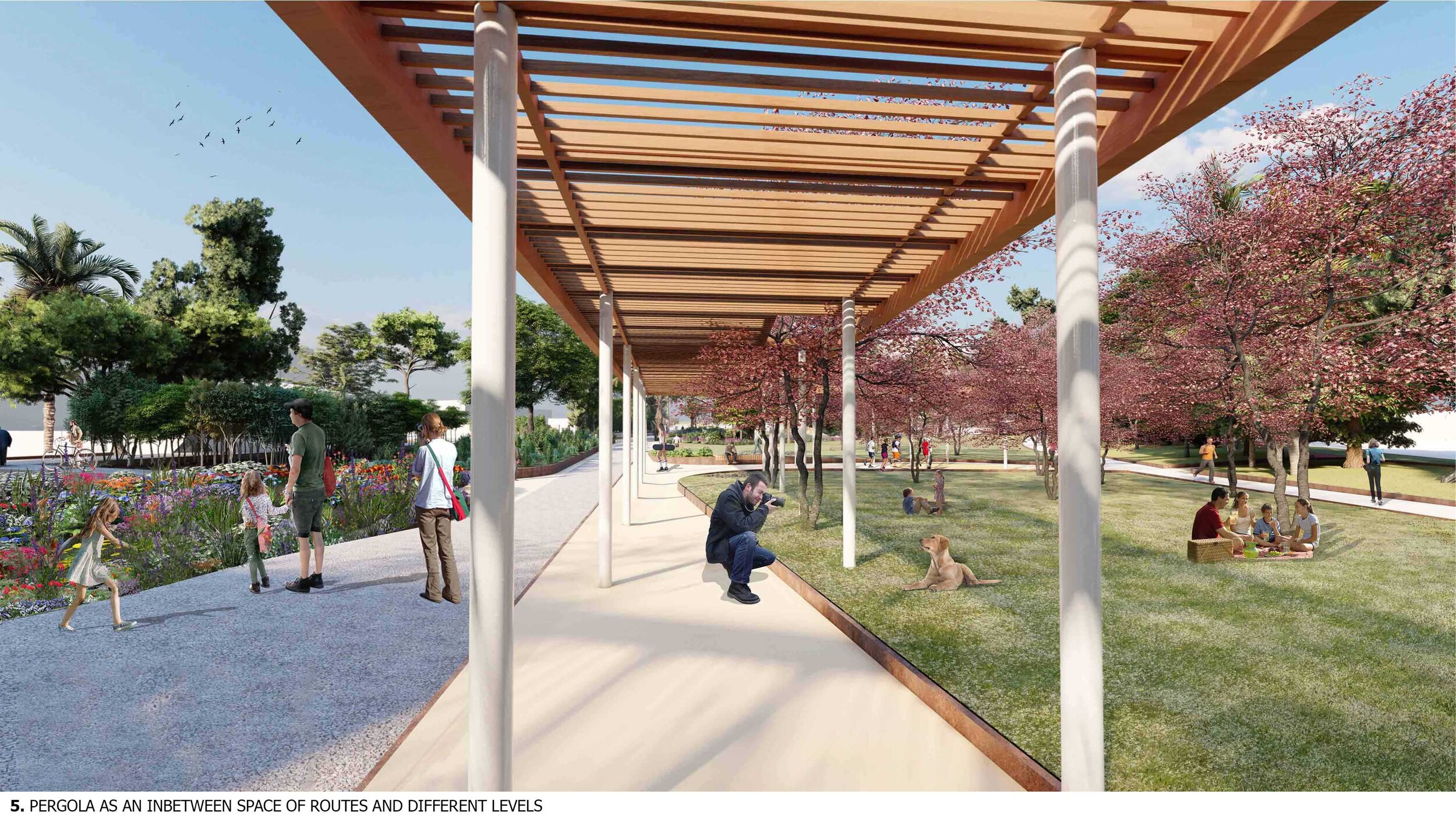
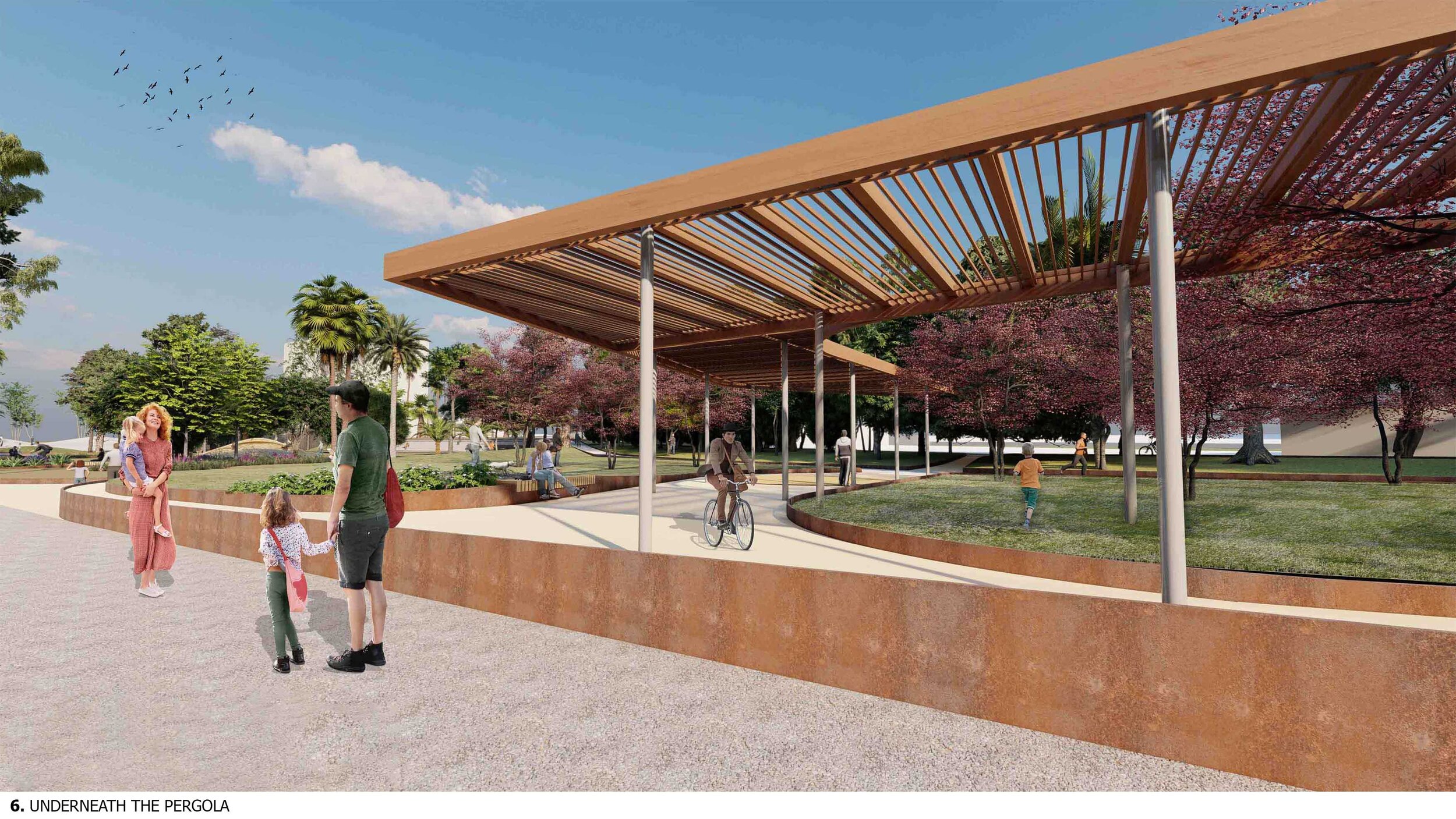
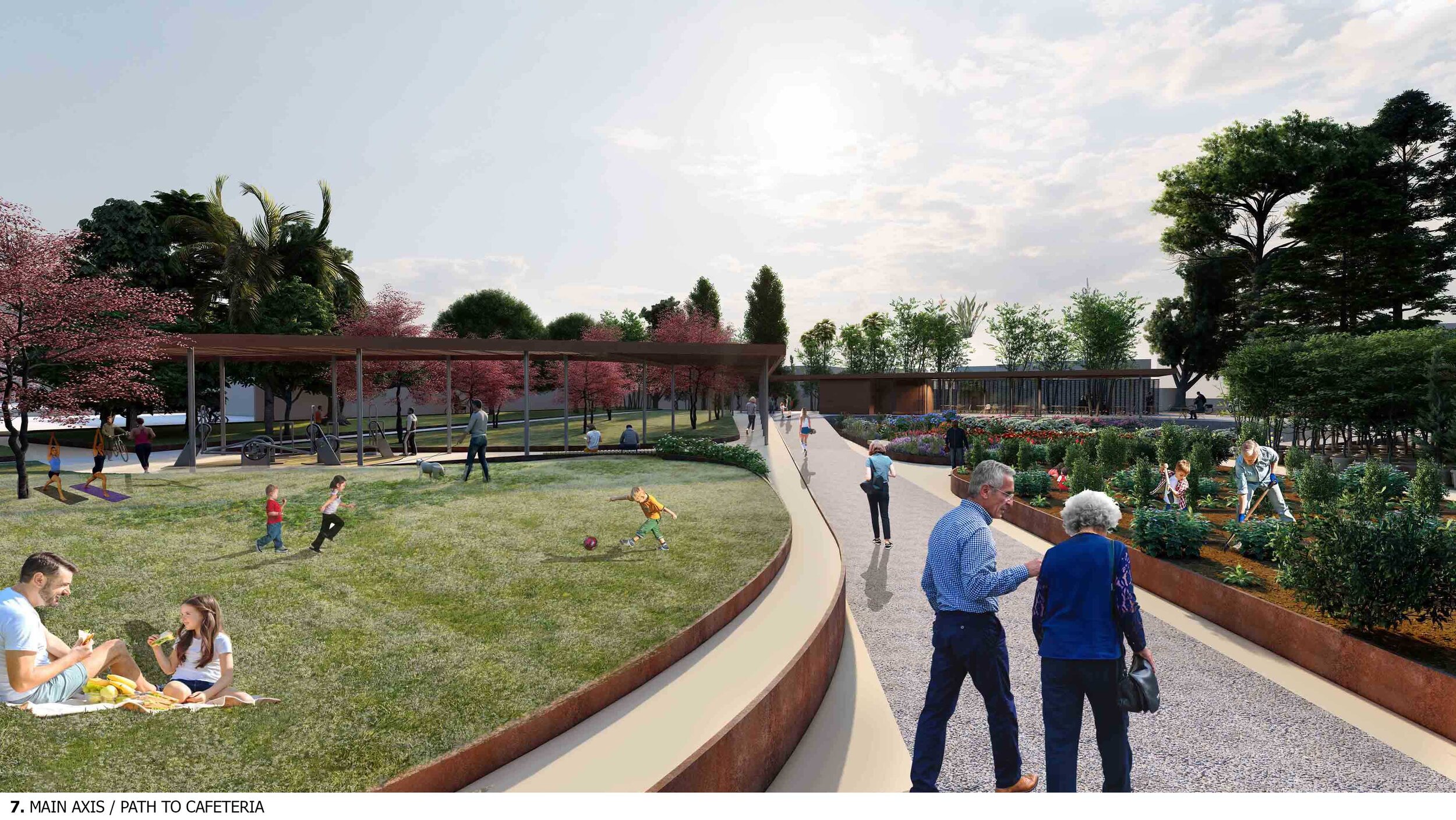
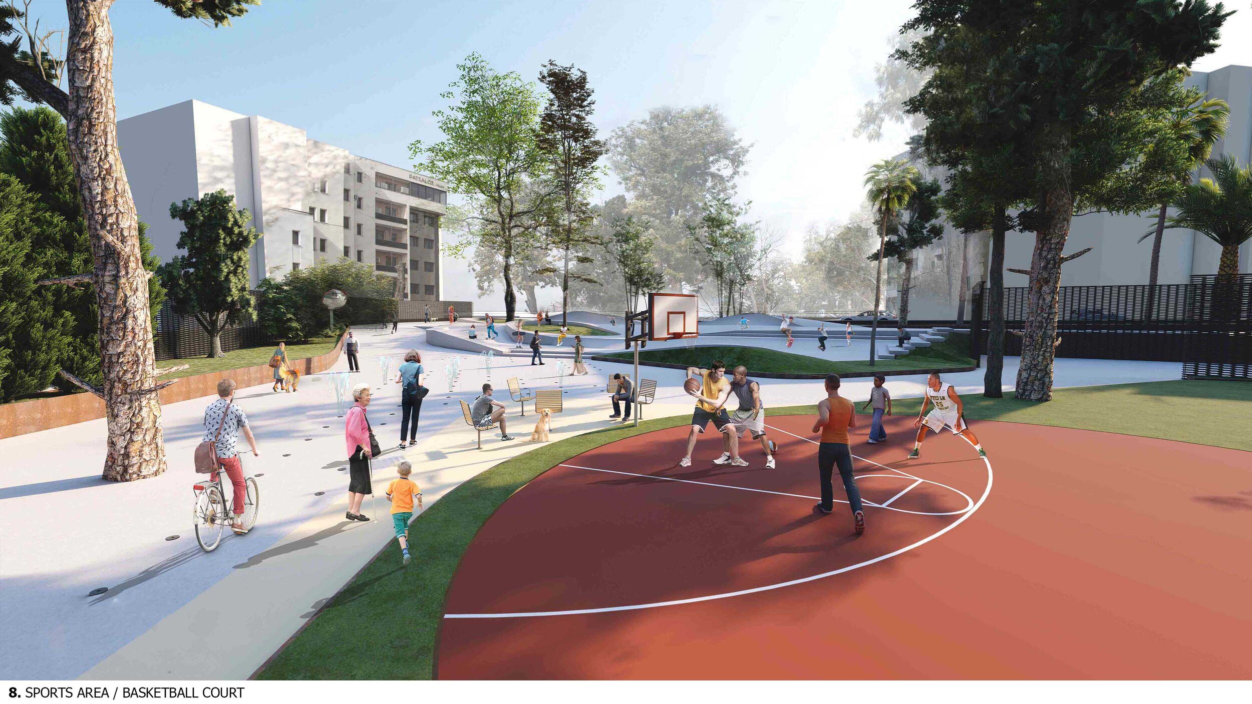
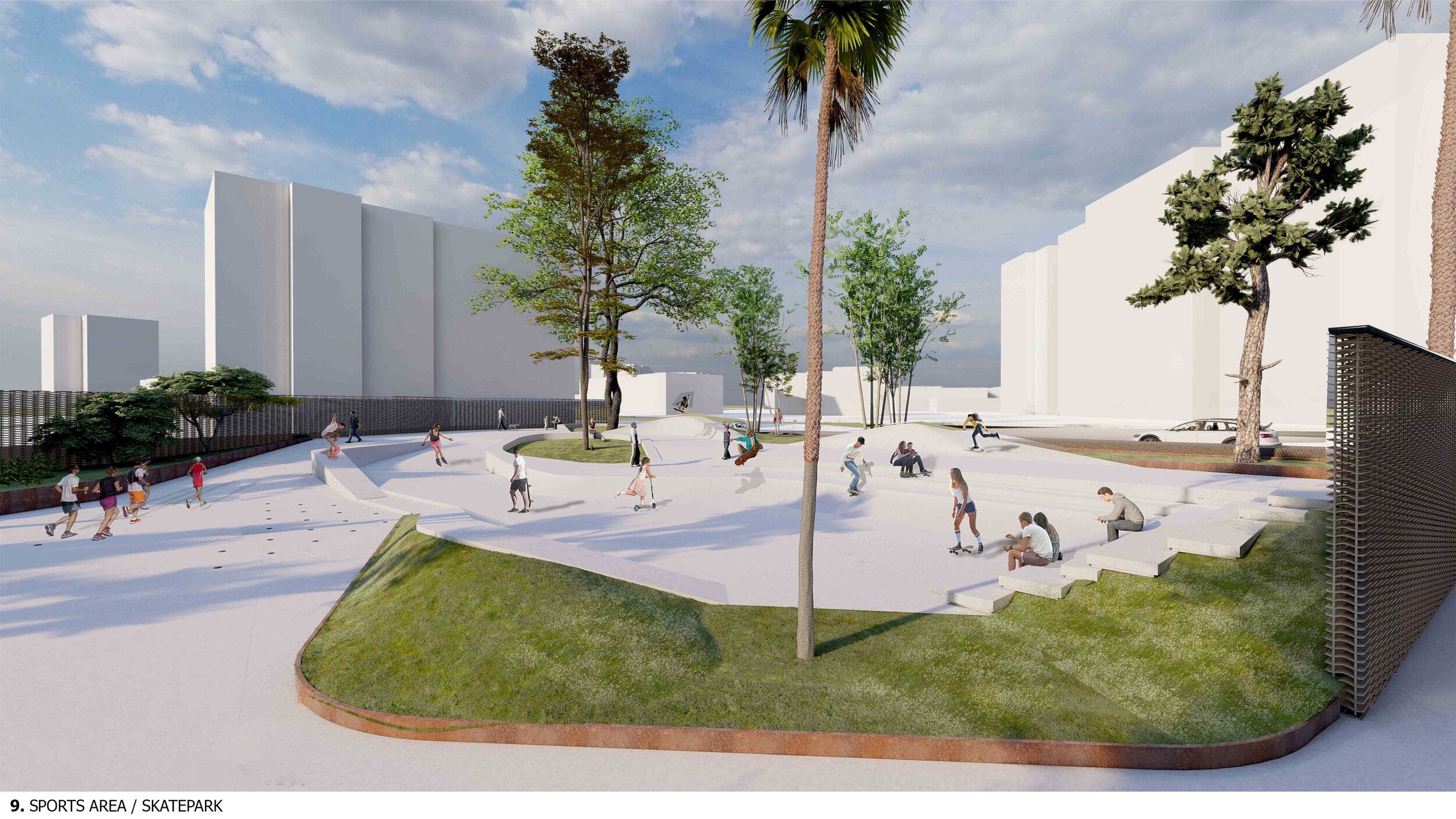
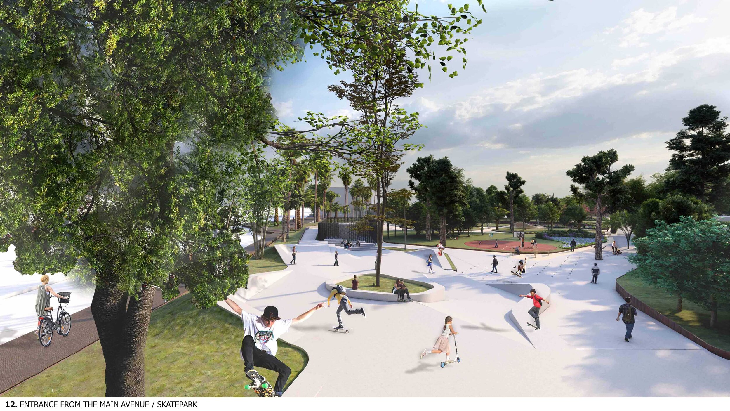
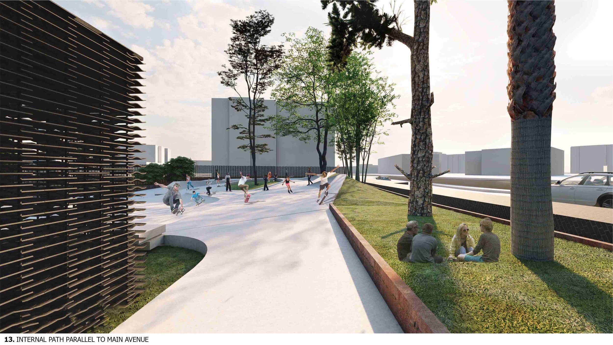
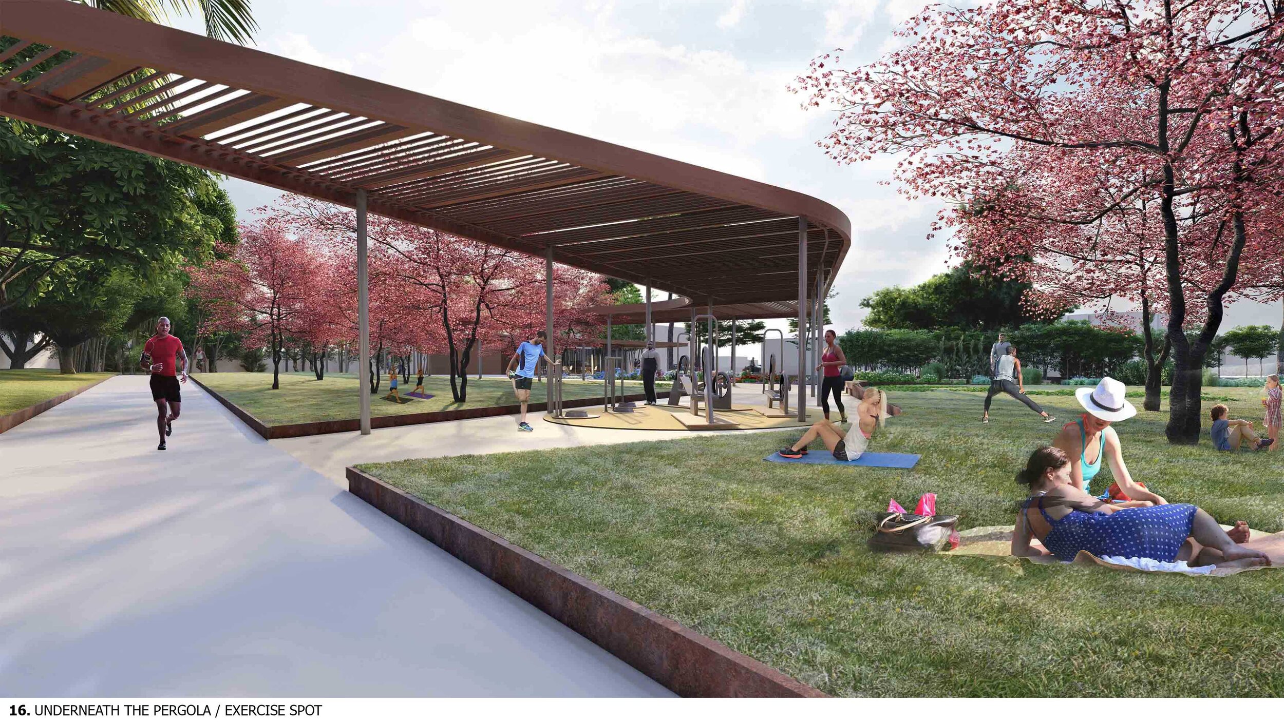
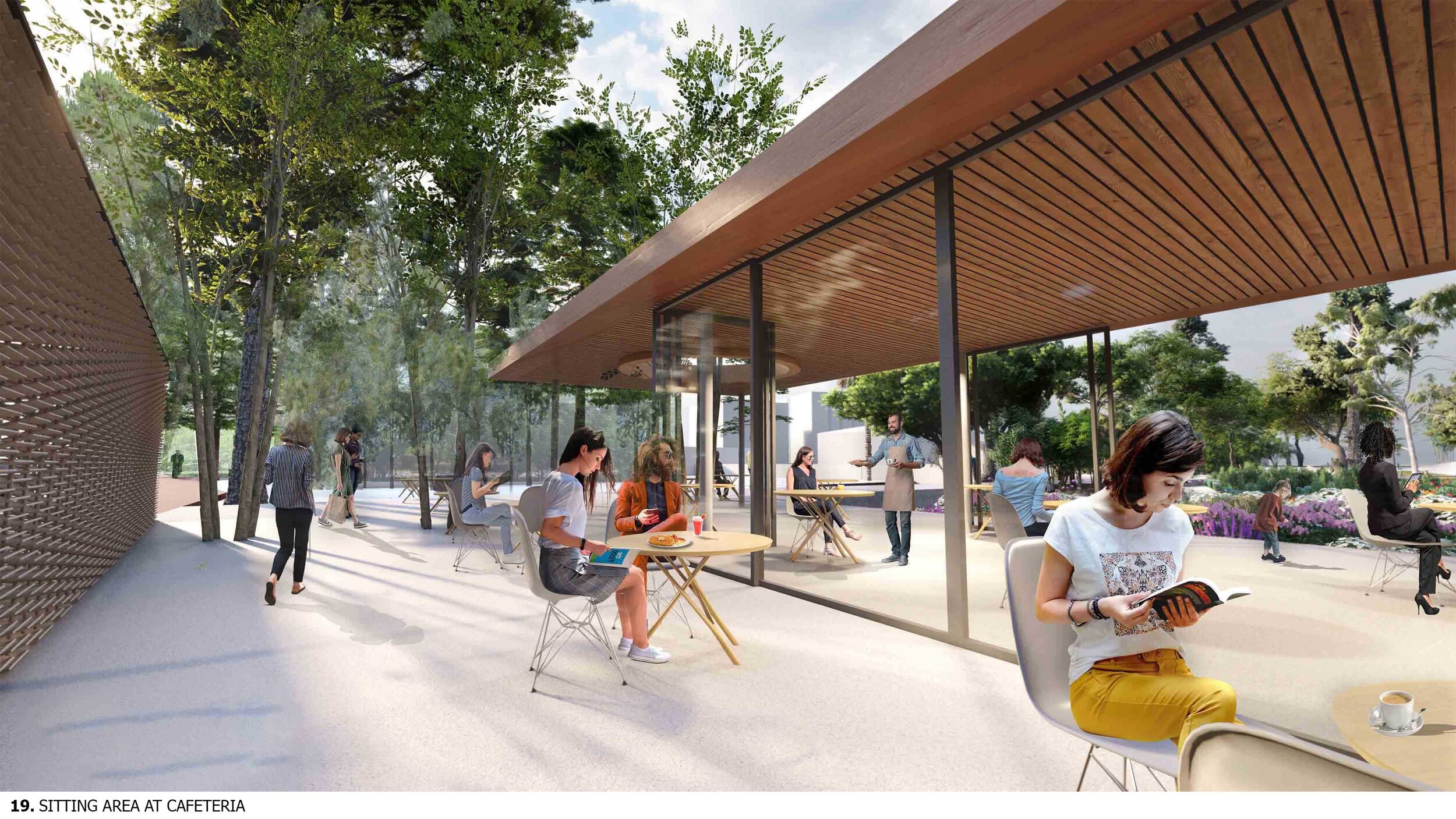
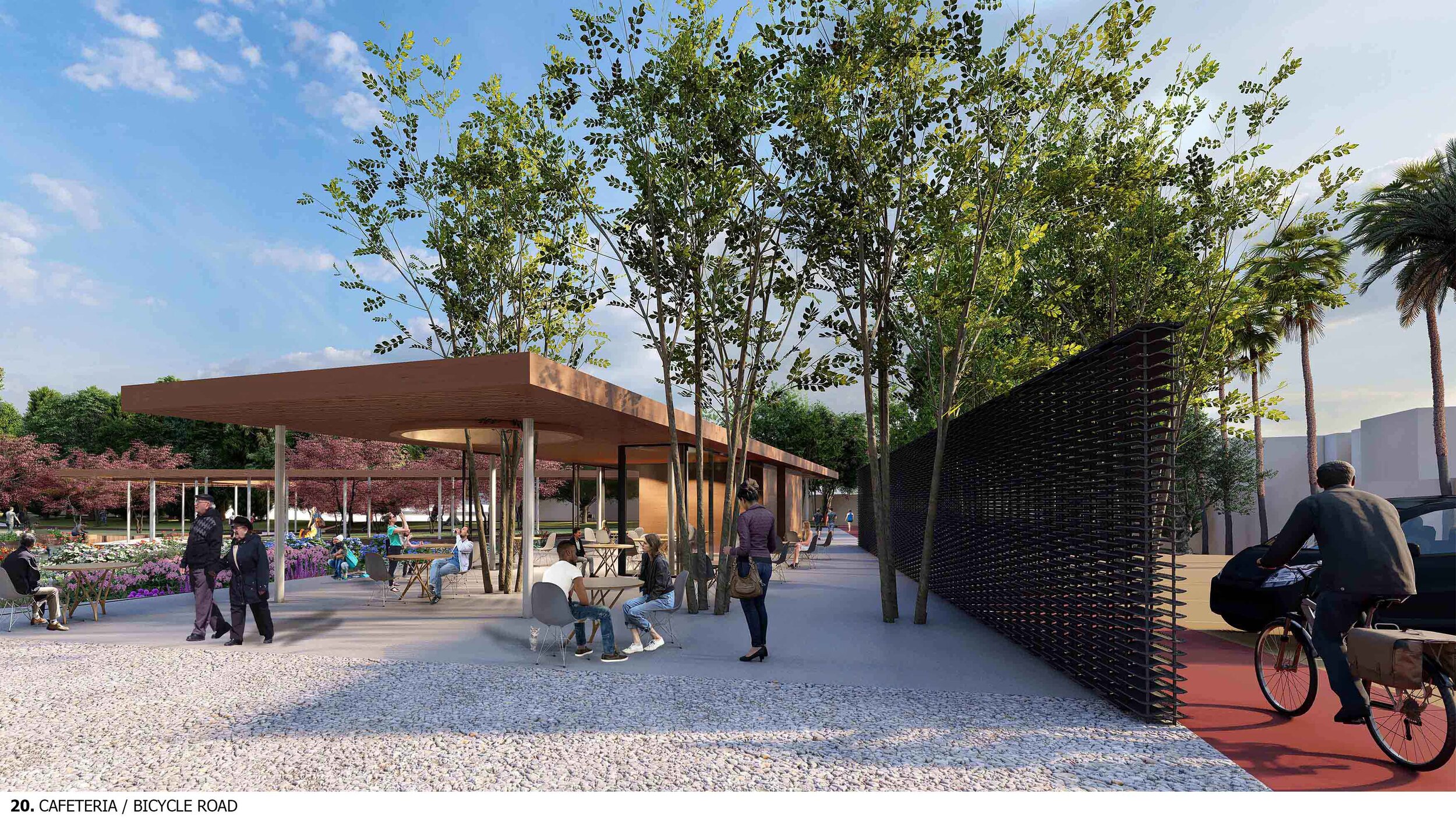
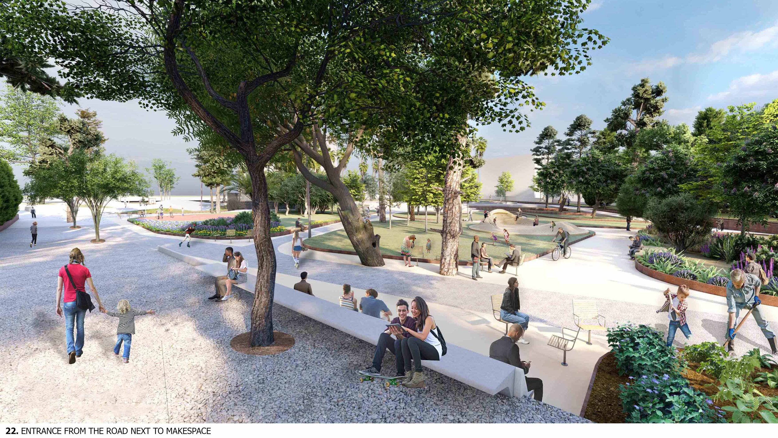
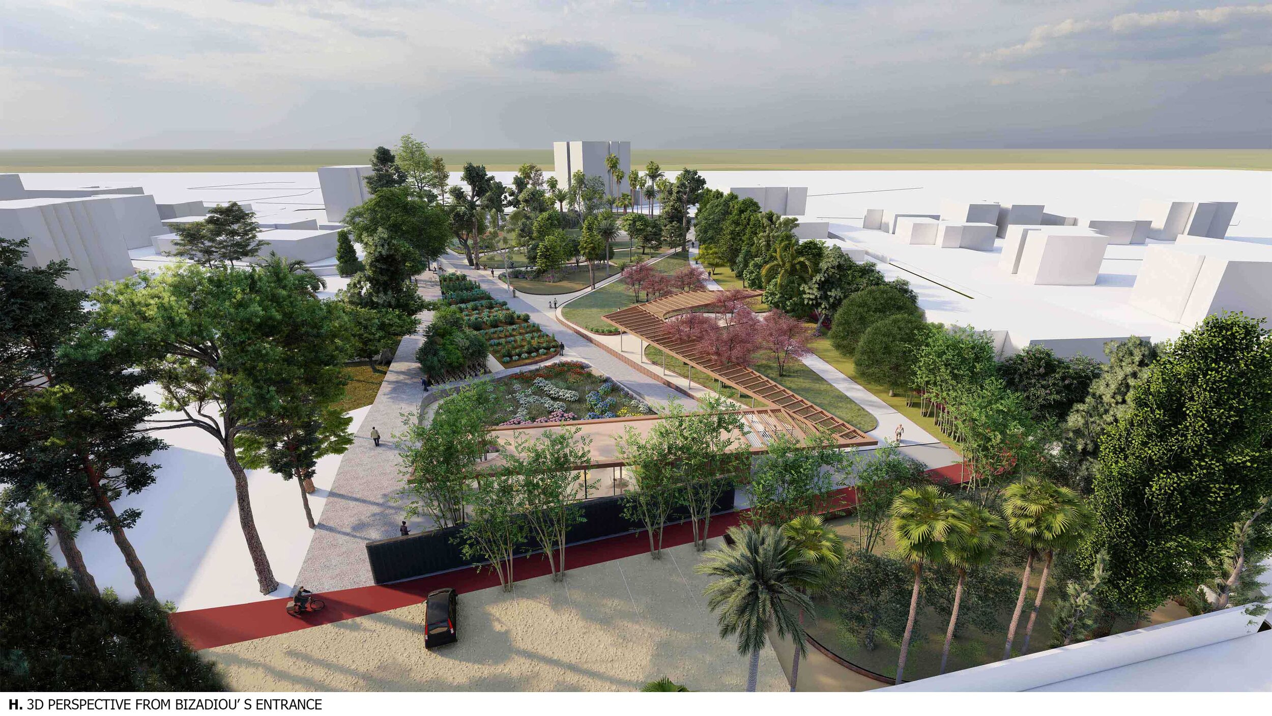
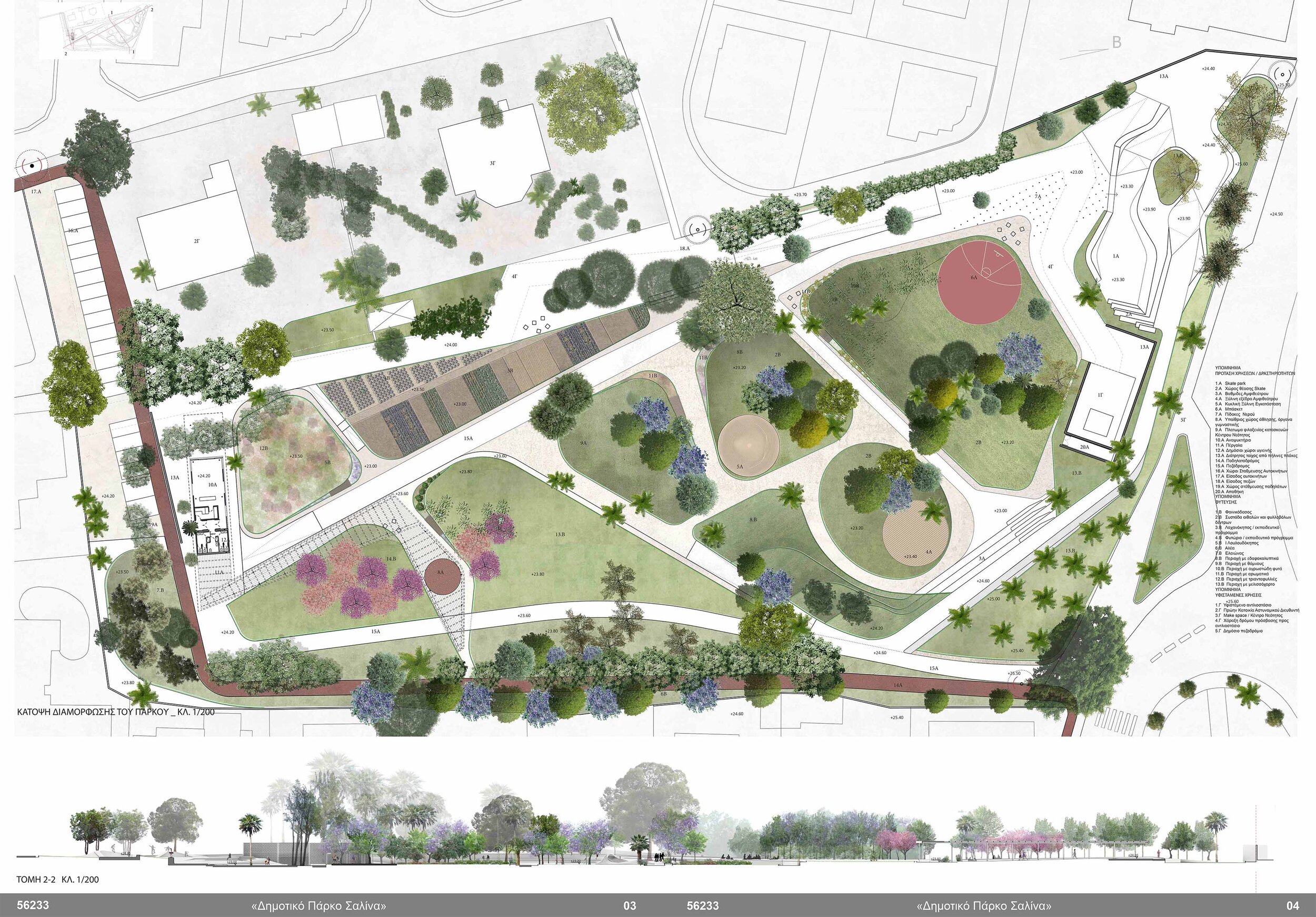
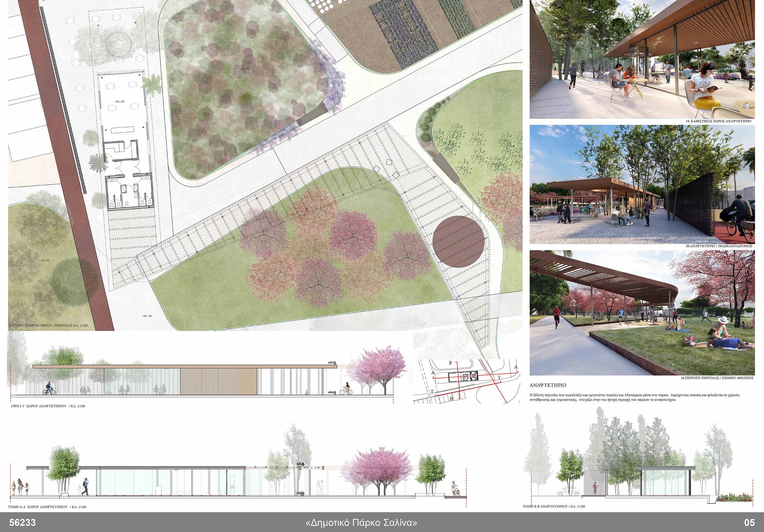
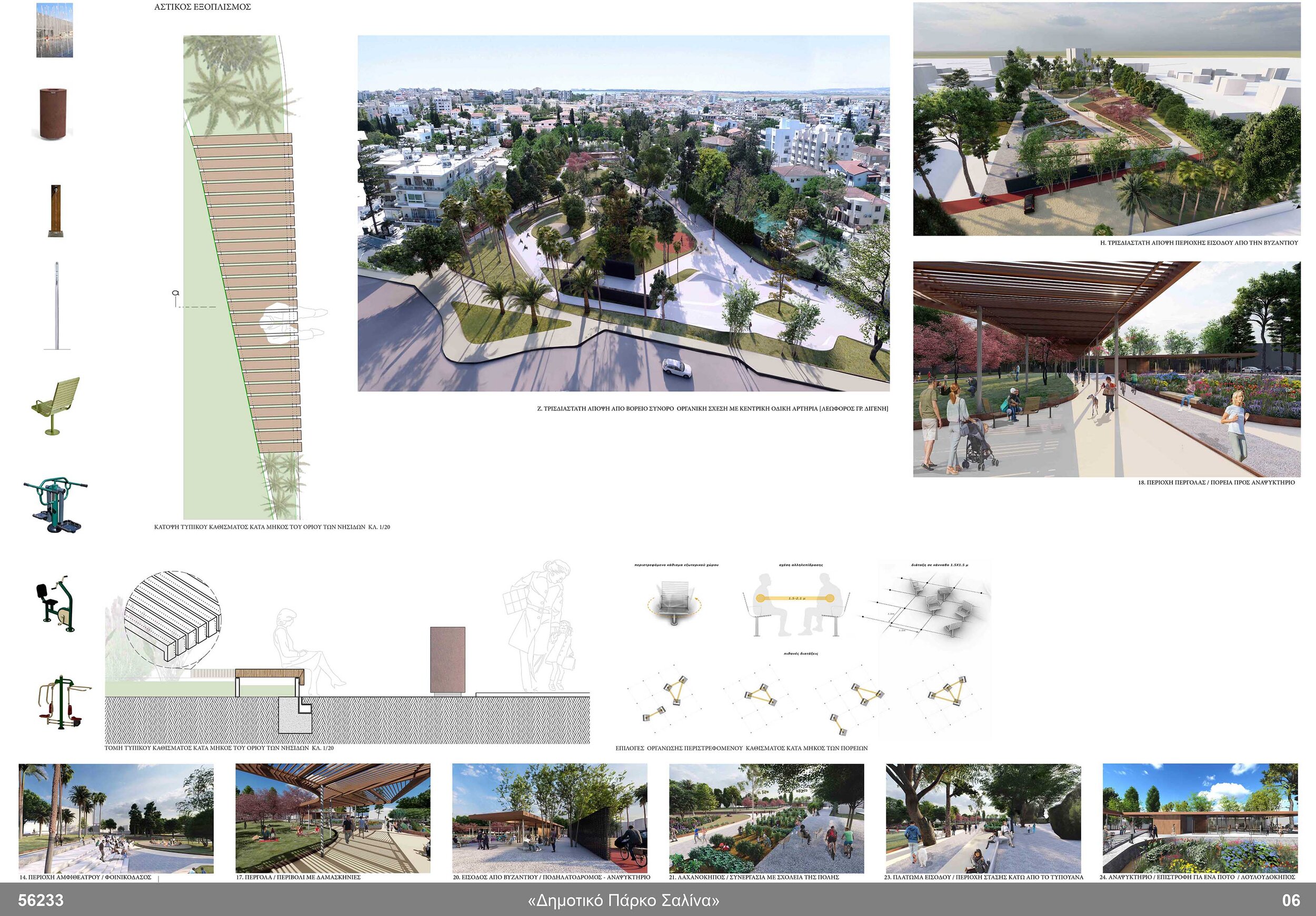
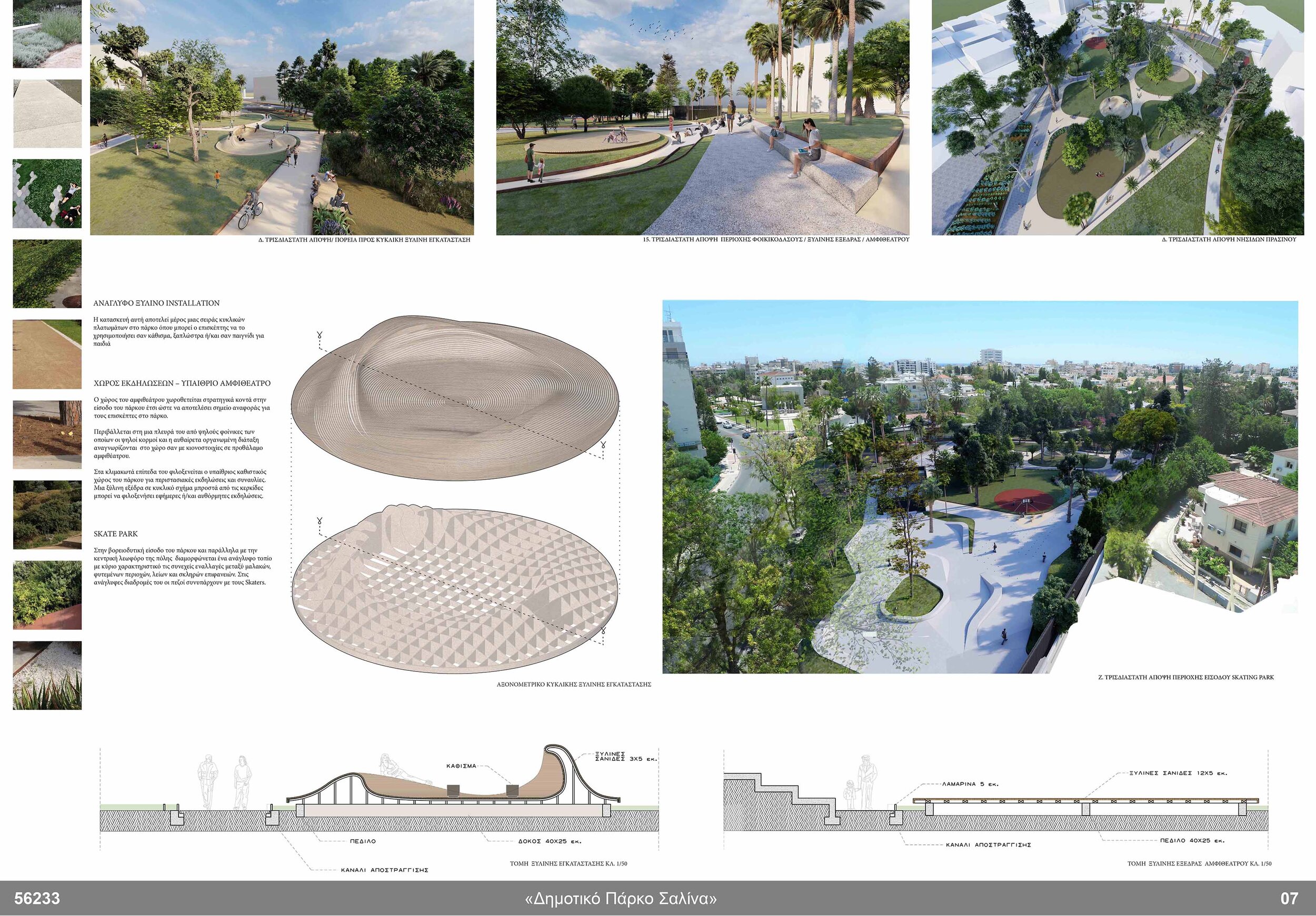
New elements and functions were added bearing always in mind the inhabitation scenarios and mixing of social and age groups, such as a refreshment room, an open air amphitheater, a skate park, a plateau and paths with fitness equipment, a water jet plaza.
![shared activities with the park and the adjacent Youth makerspace. athletic activities [skate park- basket ring - running track - strengthenic]](https://images.squarespace-cdn.com/content/v1/5b477b0ada02bcc7745eeefa/1625655673731-PPIGQNR77RHAX83XEV8V/1+diagrammes.jpg)
shared activities with the park and the adjacent Youth makerspace. athletic activities [skate park- basket ring - running track - strengthenic]

leisure activities with the adjacent municipal building ephimeral cultural activities
The contemporary identity of the park concerns its role as
a ‘topo-scape’ that connects the inner islands with the wider area and adjacent listed buildings and,
the multi-level social identity due to the hospitality it provides in potential events and activities.

existing topography_ edges of the site proposed topography_ extending and blending the topo with the edges
TOPOGRAPHY
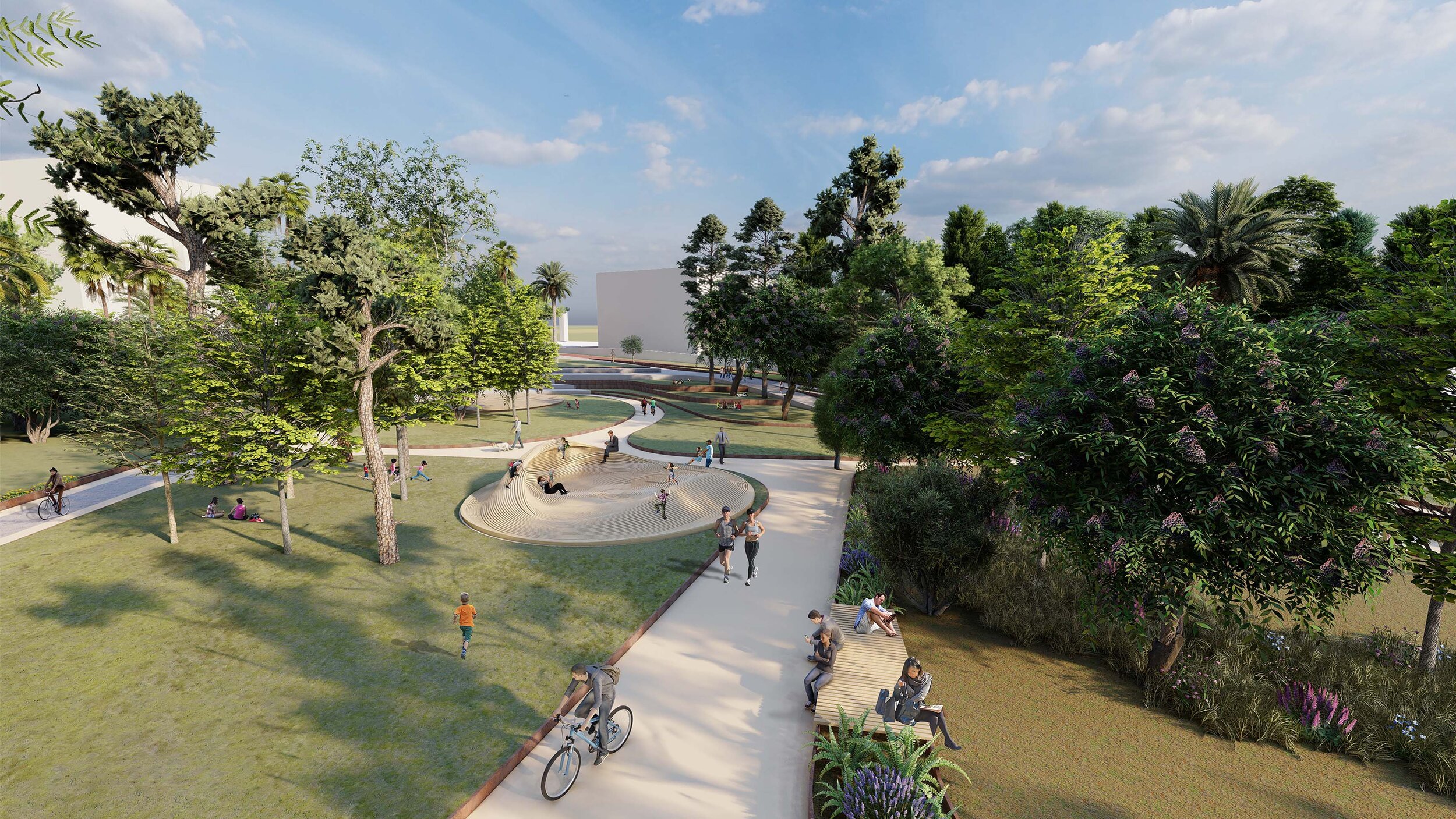
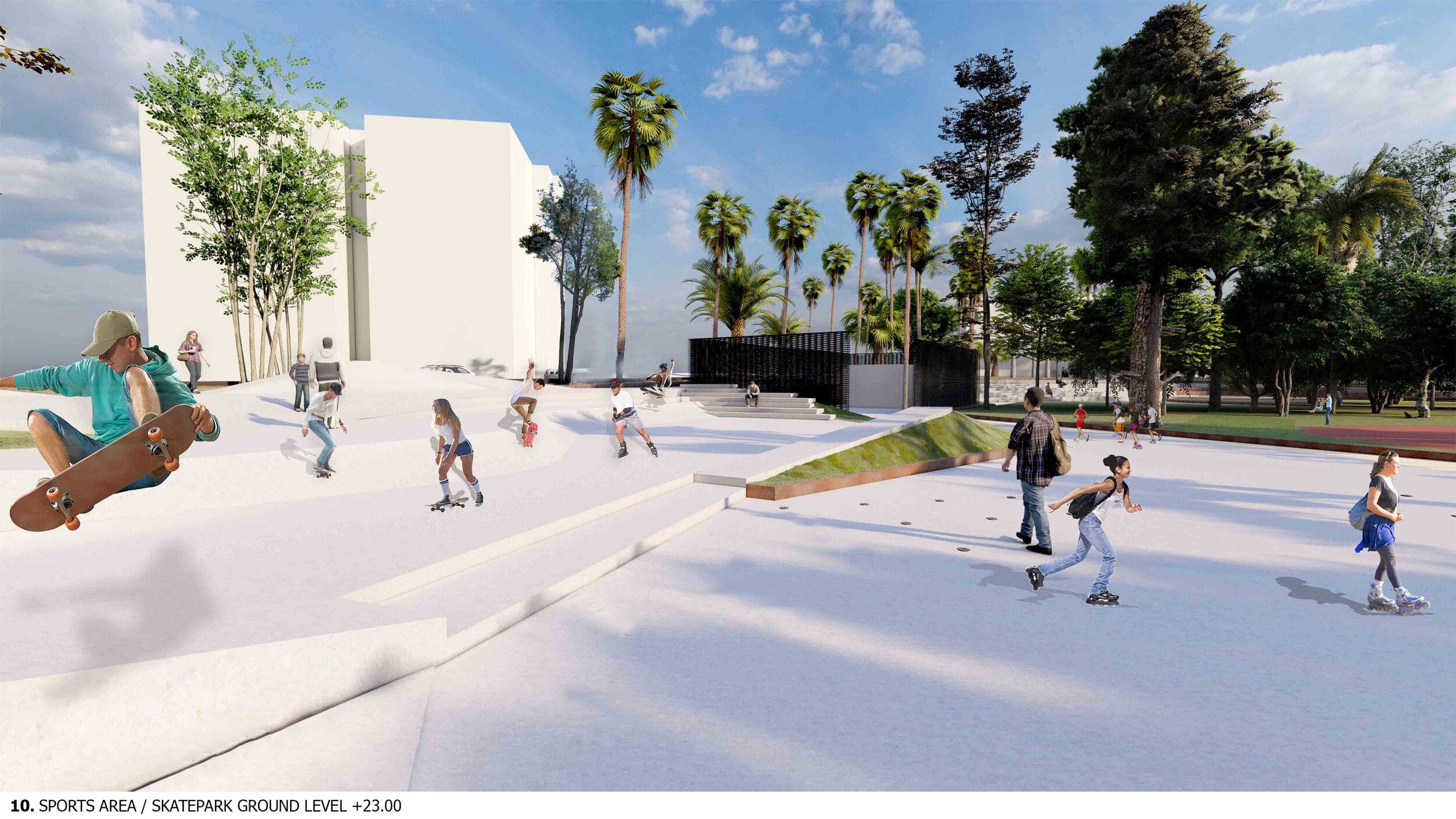
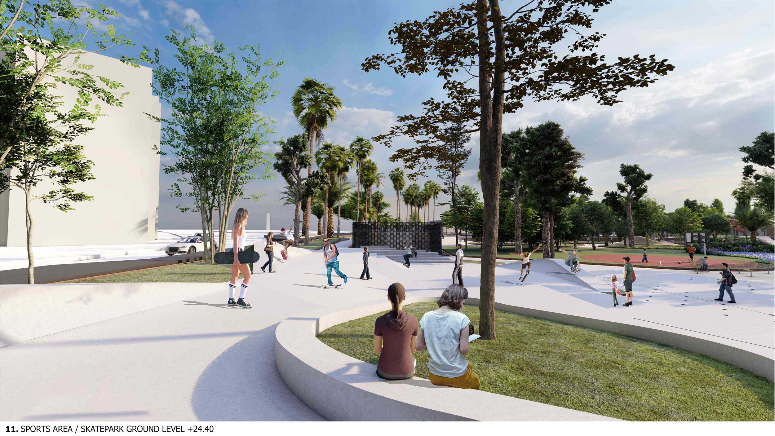
The existing topography of the site gave the possibility for ground manipulation in two main levels.
The higher level of the city’s networks [+24.50] penetrates and unfolds always in dialogue with the lower level where the main green planted areas are organised [+23.00].
The natural banks created at points of altitude difference are regenerated on stepped levels and sloping surfaces, thus creating an artificial topography that runs through the entire park.

SPACE PHYSOGNOMY- SCULPTURED LANDSCAPE
Through the stepped topography, the paths are interconnected in a network of walkways that compose a rich syntax of movement and spatial experiences.
The new topo consists of a flexible continuous surface which unfolds, stretched and expands in order to connect a series of spaces, activities and platforms. This proposed adaptable ground-scape varies according to the intention of use, the local characteristics of the micro-scale and the experiences it seeks to create.

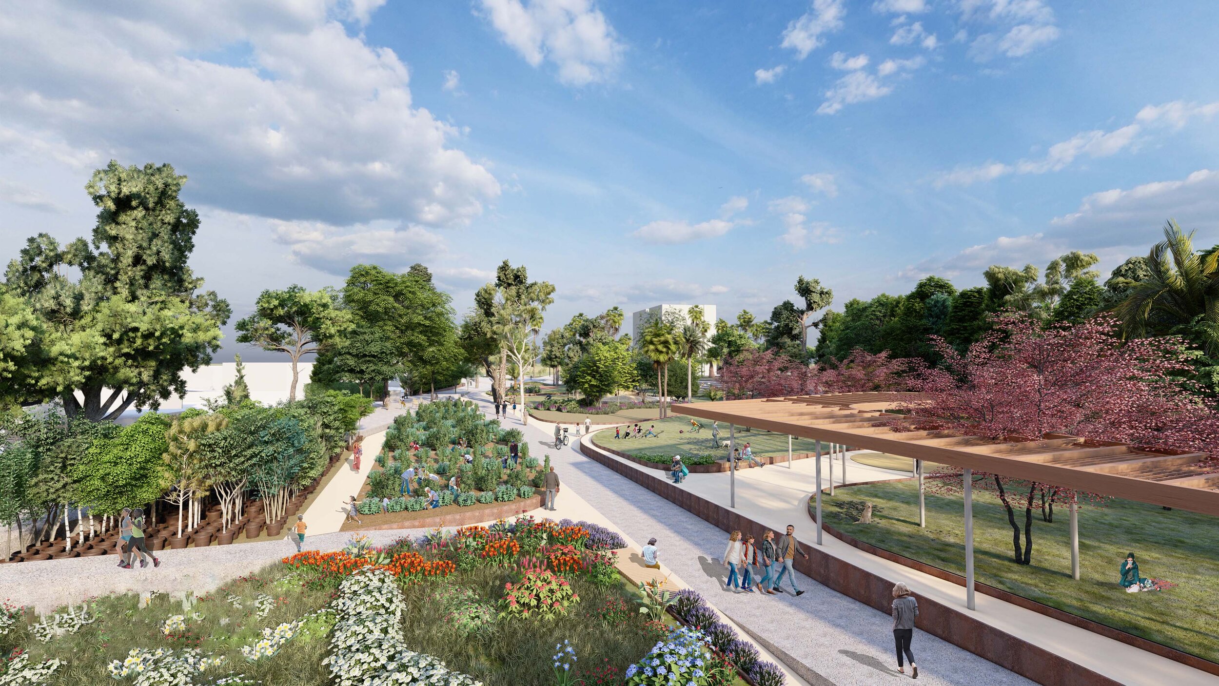
SPACE COMPOSITION - SPONTANEOUS HOSPITALITY
The proposed organization of green spaces on islets and a network of paths between them have as reference the scale of the surounding building blocks and the axes of visual connection and transportation networks of the city.
The sculpting of the islands at different altitudes manage to merge components and conditions in the surrounding areas thus responding to the micro scale of the neighborhood.

PLAN_ a network of garden islands, paths & plateaus

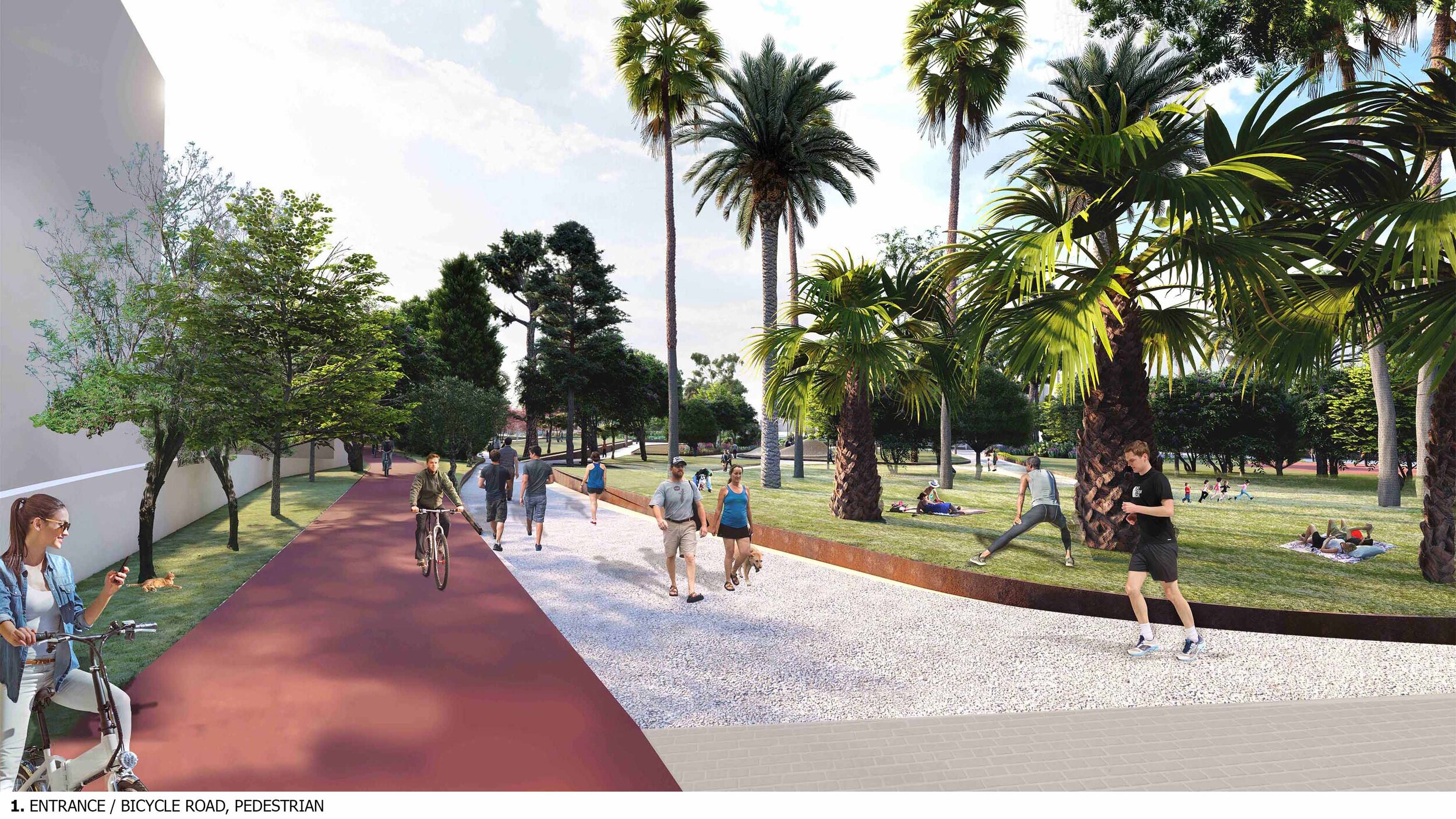
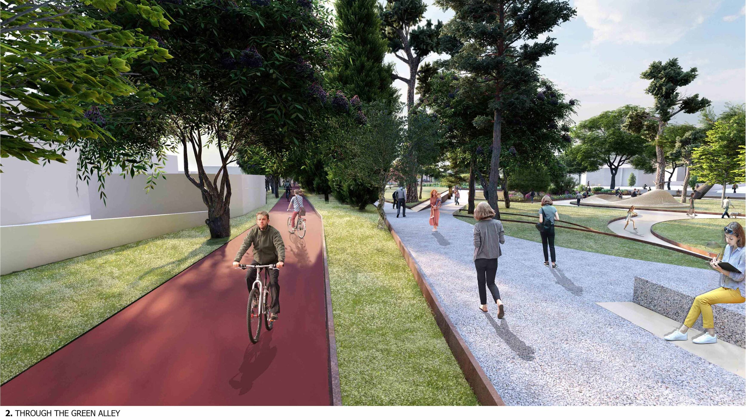
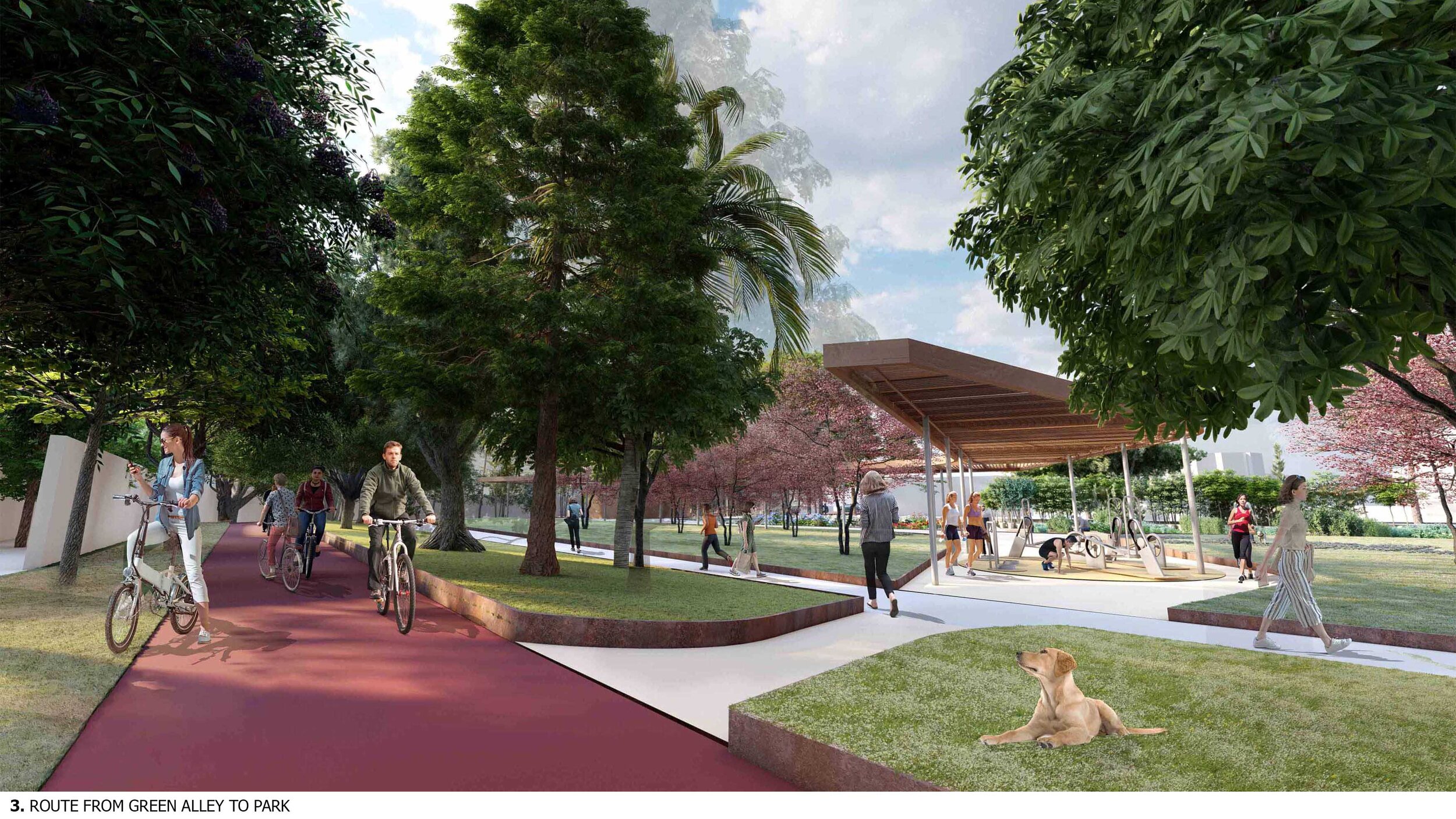

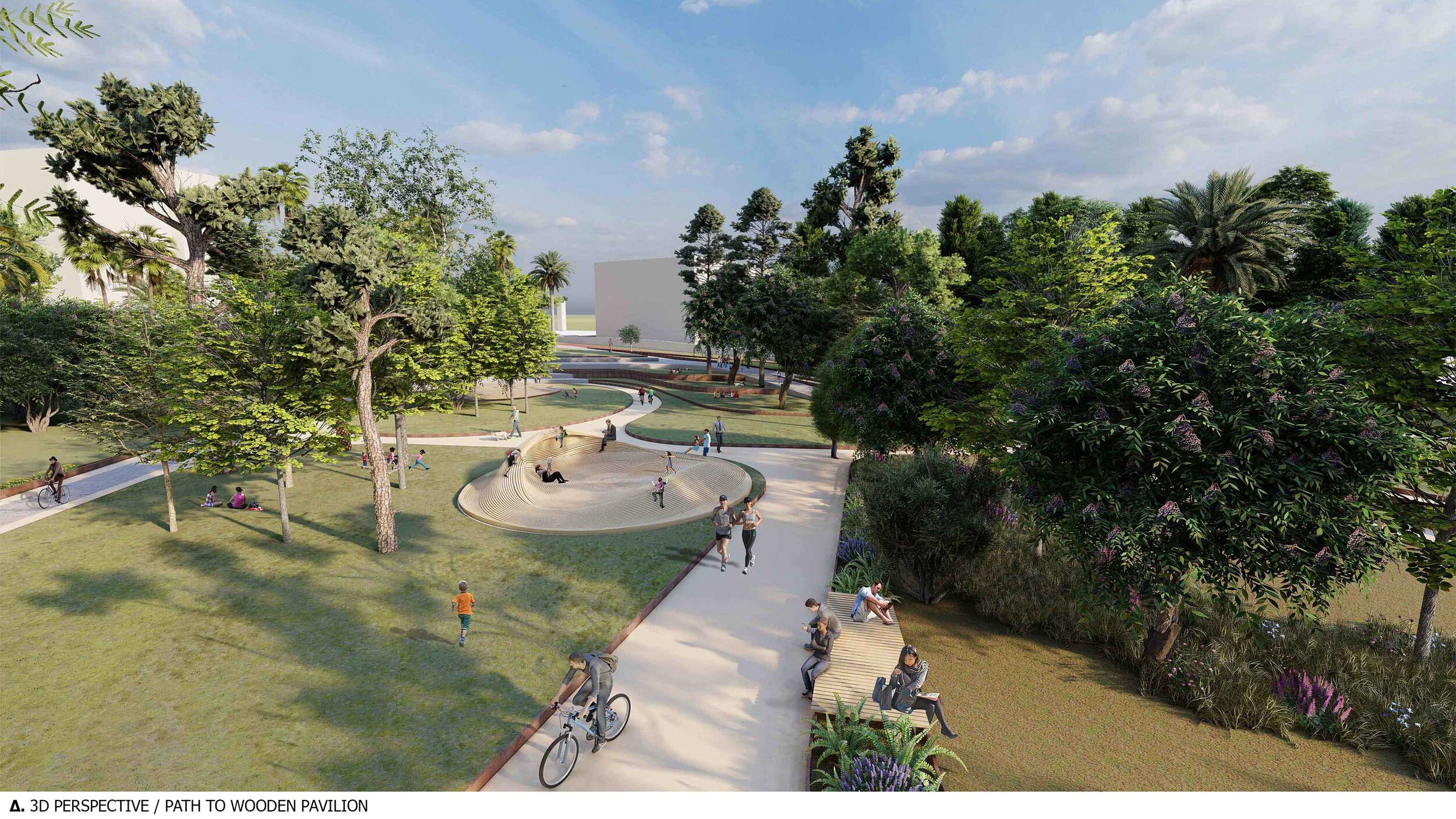
WALKING THROUGH_ pausing along the path
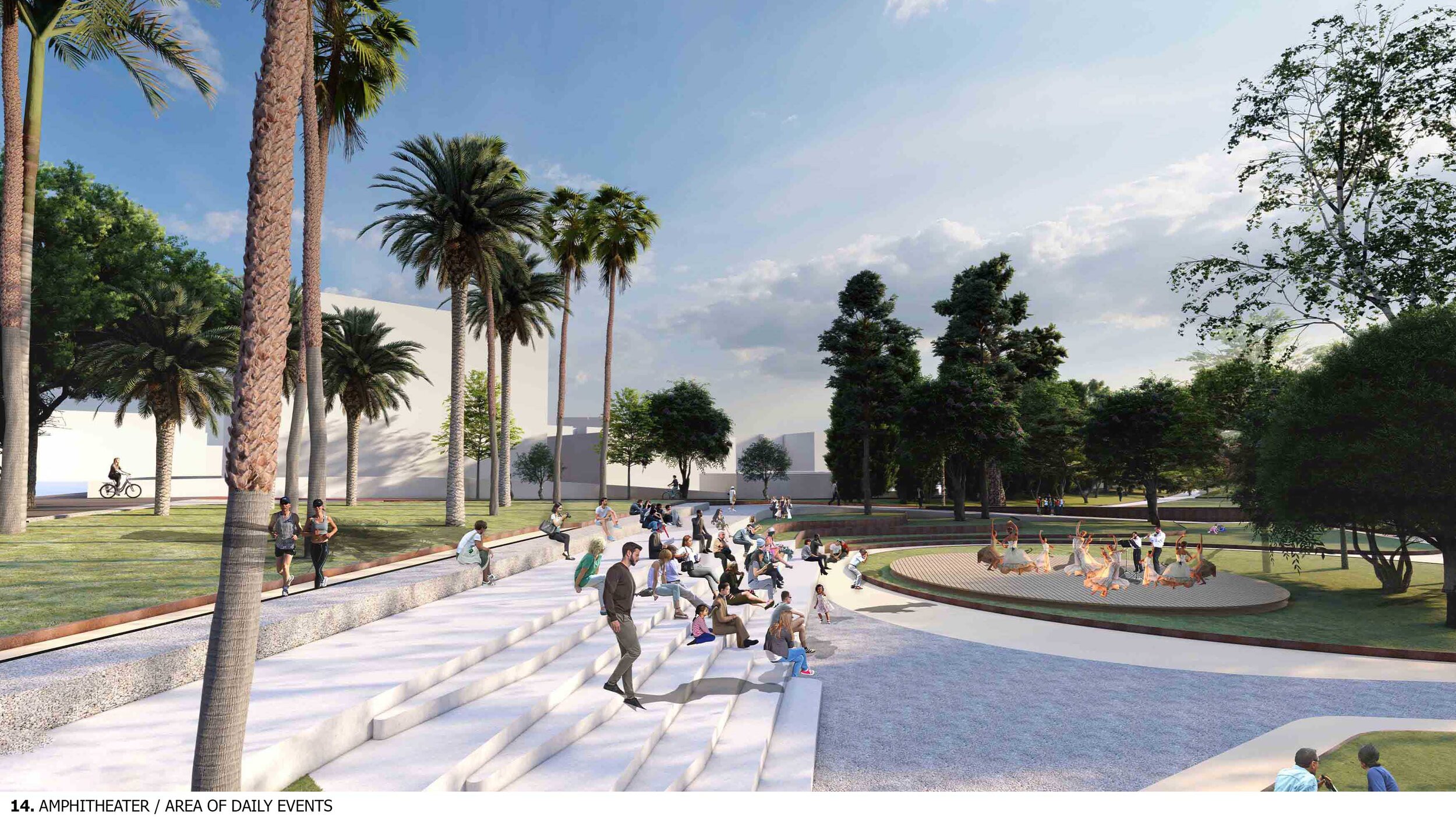
EVENTS SPACE - OUTDOOR AMPHITHEATER
The amphitheater is strategically located near the entrance of the park so that it is a reference point for visitors to the park. The pedestrian public sidewalk along the road is being extended into the site, forming plateaus that generate the amphitheatrical sculpting of the ground that is integrated within the existing topography. An island with tall palm trees at the upper level of the amphitheater acts as an entrance point to the events.

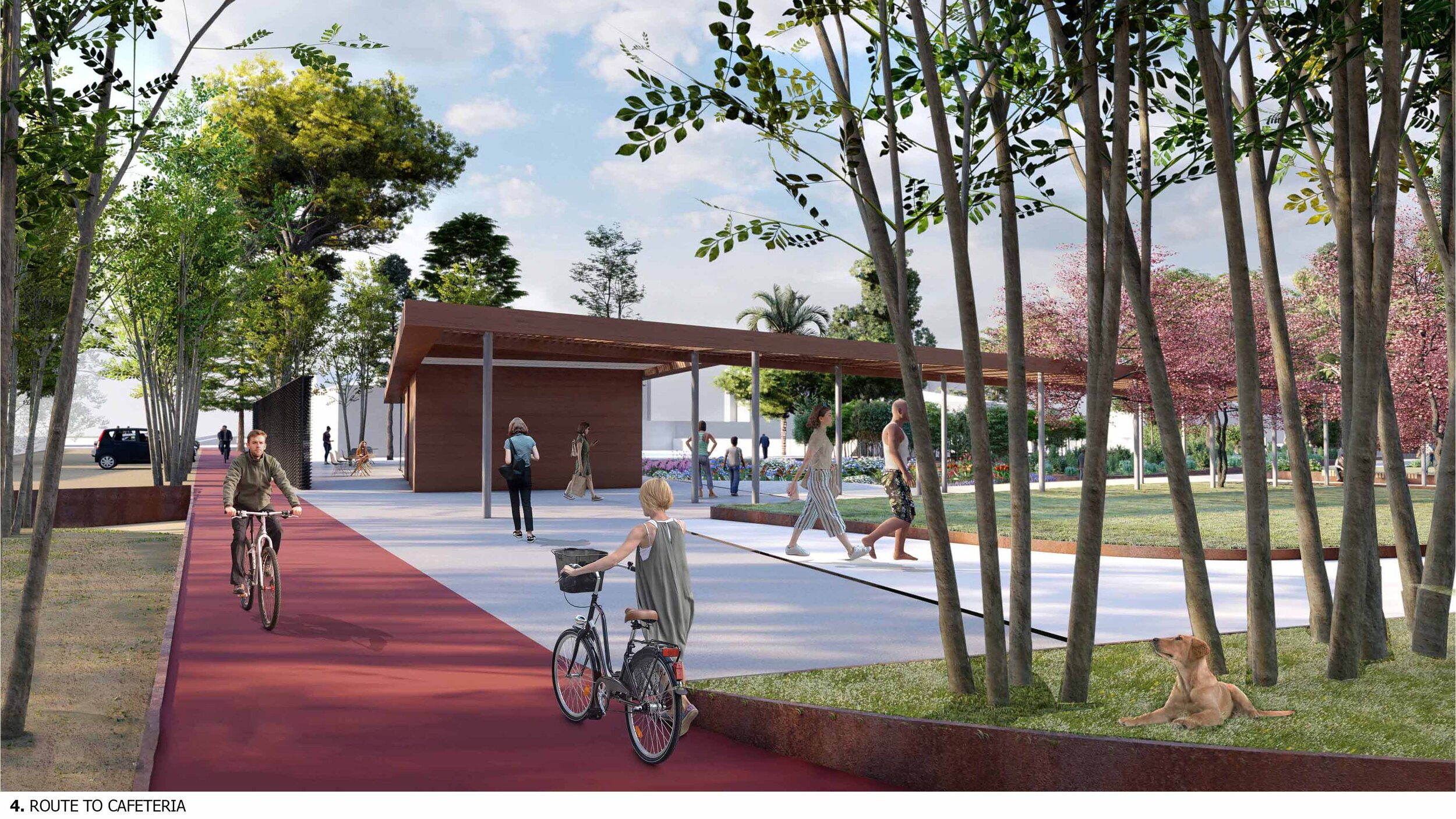
APPROACHING THE CAFETERIA AREA


SKATE PARK AREA


COMPETITION PANELS